Login

Zabudli ste prihlasovacia meno

Cookies have to be accepted!
Your browser's cookie functionality is disabled. Please enable this functionality.

Not a member yet?

Register now
Login

Available for registred users only

Log in to use this feature.

Zabudli ste prihlasovacia meno

Cookies have to be accepted!
Your browser's cookie functionality is disabled. Please enable this functionality.

Not a member yet?

Register now
Filter
Kategórie
Advanced filters
  • Dĺžka (km)
  • výškomer
Uložiť filter Reset filter

TrackRank

QRCode

Technical data

Dĺžka5,8 km výškomer576 m Way down2 m Doba00:45 h:m dátum07.12.2009
ohodnotenia Author Kraj pôžitok z túry kondícia technika

štatistika

545 náhľady ohodnotenia 68 Stiahnutia priemer
Rate
  • list trasy
  • príjazd
  • Stiahnutia

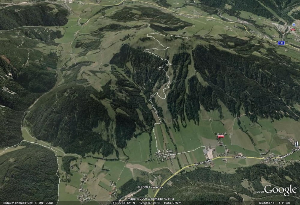
Originalstrecke des Buchensteinwandrennens. Jedes Jahr im September veranstalten die Pillerseetalbiker dieses Rennen auf den Hausberg im Pillerseetal. Eine schöne Aussicht auf die umliegende Bergwelt (Wilder Kaiser, Loferer und Leoganger Steinberge und Kitzbüheler Horn) entschädigt für die Auffahrt.

Further information at

http://www.pillerseetalbiker.at

galéria trás

Mapa trasy a výškový profil

  • Open Street Map
  • Google
Minimum height 862 m Maximum height 1436 m Detailný pohľad

More about the tour author

sportguenther
Member since 2009

Send private message

komentáre

Parkplatz der Bergbahn Pillersee.

GPS trasy

Trackpoints
  • GPX / Garmin Map Source (gpx) download
  • TCX / Garmin Training Center® (tcx) download
  • CRS / Garmin Training Center® (crs) download
  • Google Earth (kml) download
  • G7ToWin (g7t) download
  • TTQV (trk) download
  • Overlay (ovl) download
  • Fugawi (txt) download
  • Kompass (DAV) Track (tk) download
  • list trasy (pdf) download
  • Original file of the author (gpx) download

More about the tour author

sportguenther
Member since 2009

Send private message
Share track
Add to my favorites
Remove from my favorites
Edit tags
My score
Rate
trasa: Buchensteinwand-rennen
Druh: horský bicykel
Dĺžka: 5,8 km
Evaluated on:
Doba:
Day(s)
Hour(s)
Minute(s)
ohodnotenie: Kraj pôžitok z túry kondícia technika