Login

Zabudli ste prihlasovacia meno

Cookies have to be accepted!
Your browser's cookie functionality is disabled. Please enable this functionality.

Not a member yet?

Register now
Login

Available for registred users only

Log in to use this feature.

Zabudli ste prihlasovacia meno

Cookies have to be accepted!
Your browser's cookie functionality is disabled. Please enable this functionality.

Not a member yet?

Register now
Filter
Kategórie
Advanced filters
  • Dĺžka (km)
  • výškomer
Uložiť filter Reset filter

TrackRank

QRCode

Technical data

Dĺžka51,8 km výškomer508 m Way down508 m Doba00:00 h:m dátum22.08.2006
ohodnotenia Author Kraj pôžitok z túry kondícia technika

štatistika

2631 náhľady 1 ohodnotenie 289 Stiahnutia 2.00 priemer
Rate
  • list trasy
  • príjazd
  • Stiahnutia
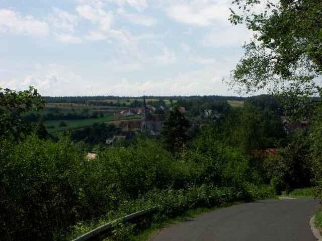
Schön Tour auf der alten Hochstraße durch den Steigerwald. Teilweise ist der Weg schon recht verwachsen.

Further information at

http://www.letmax.de/

galéria trás

Mapa trasy a výškový profil

  • Open Street Map
  • Google
Minimum height 274 m Maximum height 420 m Detailný pohľad

More about the tour author

maximal
Member since 2006

Send private message

komentáre

Winfried Ammon on 04.06.2007

Steigerwald Hochstraße

Für eine MTB Tour zuviel Teerstaßen

Ich hoffe sie hat dir trotzdem gefallen ? Es sind ja statistisch gesehen unter 40% Teer (inkl. notwendiger Ortsdurchfahrten) und das ist für unser Mittelfranken doch super. Und die Tour mit einem Trekkingrad zu machen ist nicht wirklich ratsam, oder doch ??

GPS trasy

Trackpoints
  • GPX / Garmin Map Source (gpx) download
  • TCX / Garmin Training Center® (tcx) download
  • CRS / Garmin Training Center® (crs) download
  • Google Earth (kml) download
  • G7ToWin (g7t) download
  • TTQV (trk) download
  • Overlay (ovl) download
  • Fugawi (txt) download
  • Kompass (DAV) Track (tk) download
  • list trasy (pdf) download

More about the tour author

maximal
Member since 2006

Send private message
Share track
Add to my favorites
Remove from my favorites
Edit tags
My score
Rate
trasa: Steigerwald Hochstraße
Druh: horský bicykel
Dĺžka: 51,8 km
Evaluated on:
Doba:
Day(s)
Hour(s)
Minute(s)
ohodnotenie: Kraj pôžitok z túry kondícia technika