


Schöne Runde mit allem was der Biker sucht.
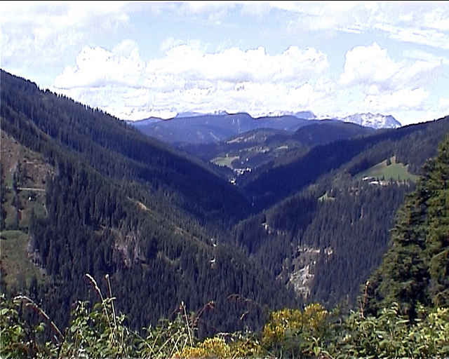
Dowhill,schmale Pfade und einenLandschaftlich tollen Ausblick.
Die Tour Startet in Richtung Kulm.
Einzelne Punkte der Tour:Start Haus Jägerrast.
Kühlhaus in Kulm,Panoramahotel auf dem Kulmberg, Rollerstrecke,Haus Arnika,Sonnenalm,Ochsenalm,Liftstüberl am Badesee.
Wer sich den Anstieg zum Haus Jägerrast Sparen möchte kann an der WM Schanze Starten
Further information at
http://www.members.aon.at/jaegerrast/galéria trás
Mapa trasy a výškový profil
Minimum height 1081 m
Maximum height 1304 m
More about the tour author

|
Rüdiger 60 |
komentáre

Von Salzburg die A10 Richtung Graz bis Eben im Pongau nun Richtung Filzmoos und Ramsau am Dachstein
GPS trasy
Trackpoints-
GPX / Garmin Map Source (gpx) download
-
TCX / Garmin Training Center® (tcx) download
-
CRS / Garmin Training Center® (crs) download
-
Google Earth (kml) download
-
G7ToWin (g7t) download
-
TTQV (trk) download
-
Overlay (ovl) download
-
Fugawi (txt) download
-
Kompass (DAV) Track (tk) download
-
list trasy (pdf) download
-
Original file of the author (gpx) download
More about the tour author
|
|
Rüdiger 60 |
Add to my favorites
Remove from my favorites
Edit tags
Open track
My score
Rate