Login

Zabudli ste prihlasovacia meno

Cookies have to be accepted!
Your browser's cookie functionality is disabled. Please enable this functionality.

Not a member yet?

Register now
Login

Available for registred users only

Log in to use this feature.

Zabudli ste prihlasovacia meno

Cookies have to be accepted!
Your browser's cookie functionality is disabled. Please enable this functionality.

Not a member yet?

Register now
Filter
Kategórie
Advanced filters
  • Dĺžka (km)
  • výškomer
Uložiť filter Reset filter

TrackRank

QRCode

Technical data

Dĺžka3,7 km výškomer802 m Way down0 m Doba02:30 h:m dátum24.02.2010
ohodnotenia Author Kraj pôžitok z túry kondícia technika

štatistika

380 náhľady ohodnotenia 48 Stiahnutia priemer
Rate
  • list trasy
  • príjazd
  • Stiahnutia

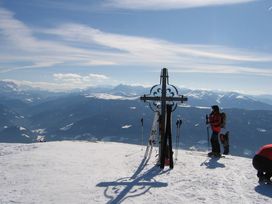
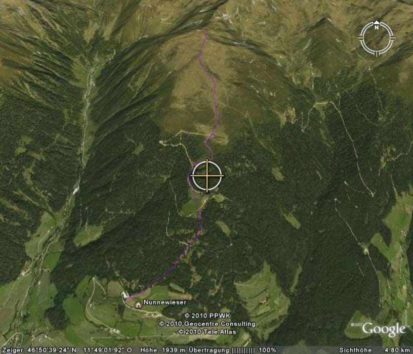
Der Aufstieg geht vom Gasthof Nunnewieser bei Terenten zunächst durch den Wald, dann über die Pertinger Alm zum Gipfel.

Further information at

http://www.hotknott.com/basecamp/tour/skitouren/italien/suedtirol/am-joch-2405-m_4873

galéria trás

Mapa trasy a výškový profil

  • Open Street Map
  • Google
Minimum height 1600 m Maximum height 2422 m Detailný pohľad

More about the tour author

bikerunner
Member since 2009

Send private message

komentáre

Brenner-Autobahn-Pustertal-Terenten

GPS trasy

Trackpoints
  • GPX / Garmin Map Source (gpx) download
  • TCX / Garmin Training Center® (tcx) download
  • CRS / Garmin Training Center® (crs) download
  • Google Earth (kml) download
  • G7ToWin (g7t) download
  • TTQV (trk) download
  • Overlay (ovl) download
  • Fugawi (txt) download
  • Kompass (DAV) Track (tk) download
  • list trasy (pdf) download
  • Original file of the author (gpx) download

More about the tour author

bikerunner
Member since 2009

Send private message
Share track
Add to my favorites
Remove from my favorites
Edit tags
My score
Rate
trasa: Am Joch 2405 m
Druh: lyže
Dĺžka: 3,7 km
Evaluated on:
Doba:
Day(s)
Hour(s)
Minute(s)
ohodnotenie: Kraj pôžitok z túry kondícia technika