
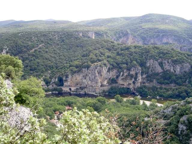

Wanderung in Salavas, vom Parkplatz aus zu einer kleinen Roemerbrücke (hier kann man dem ausgetocknetem Flussbett folgen bis zur Ardeche). Unser Rundweg führt jedoch zurück durch den Steinwald mit dem einzigartigen Blick auf die Ardeche und deren Umgebung.
Steinige Pfade, festes Schuhwerk empfohlen.
Weiterführender Link auf Französisch
Steinige Pfade, festes Schuhwerk empfohlen.
Weiterführender Link auf Französisch
Further information at
http://www.vallon-pont-darc.com/site_fr/pratiques_fr/communes.htmgaléria trás

Mapa trasy a výškový profil
Minimum height 117 m
Maximum height 262 m
More about the tour author

|
christiankrier |
komentáre

GPS trasy
Trackpoints-
GPX / Garmin Map Source (gpx) download
-
TCX / Garmin Training Center® (tcx) download
-
CRS / Garmin Training Center® (crs) download
-
Google Earth (kml) download
-
G7ToWin (g7t) download
-
TTQV (trk) download
-
Overlay (ovl) download
-
Fugawi (txt) download
-
Kompass (DAV) Track (tk) download
-
list trasy (pdf) download
-
Original file of the author (gpx) download
More about the tour author
|
|
christiankrier |
Add to my favorites
Remove from my favorites
Edit tags
Open track
My score
Rate