Login

Zabudli ste prihlasovacia meno

Cookies have to be accepted!
Your browser's cookie functionality is disabled. Please enable this functionality.

Not a member yet?

Register now
Login

Available for registred users only

Log in to use this feature.

Zabudli ste prihlasovacia meno

Cookies have to be accepted!
Your browser's cookie functionality is disabled. Please enable this functionality.

Not a member yet?

Register now
Filter
Kategórie
Advanced filters
  • Dĺžka (km)
  • výškomer
Uložiť filter Reset filter

TrackRank

QRCode

Technical data

Dĺžka9,5 km výškomer393 m Way down385 m Doba03:50 h:m dátum05.04.2010
ohodnotenia Author Kraj pôžitok z túry kondícia technika

štatistika

815 náhľady ohodnotenia 242 Stiahnutia priemer
Rate
  • list trasy
  • príjazd
  • Stiahnutia

Wer trittsicher, schwindelfrei und einigermaßen gut zu Fuß ist sollte auch mal eine derartige Tour probieren. Bergstiefel sind unabdingbar.

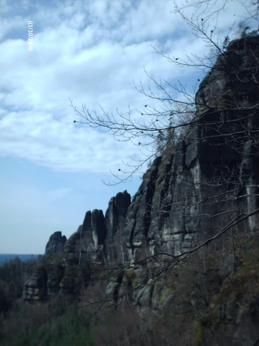
Die Sächsische Schweiz, das Klettereldorado der ehemaligen DDR, bietet eine Vielzahl von Steiganlagen und Pfaden im Sandstein. Bequeme Tagestouren, die im Hotel beginnen und enden sind die Regel. Keinesfalls sollten Kletterexperimente am Fels unternommen werden!

Der Nationalpark ist auch mit Gaststätten gut ausgestattet. Jedoch ist bei dieser Tour nur am Anfang bzw. Ende eine solche. Ein kleiner Abzweig zum Großen Winterberg (ca. 2km) kann Abhilfe schaffen. Wegweiser nach der Idagrotte helfen.

Further information at

http://www.schmilka.de

galéria trás

Mapa trasy a výškový profil

  • Open Street Map
  • Google
Minimum height 117 m Maximum height 480 m Detailný pohľad

More about the tour author

DieAlten
Member since 2011

Send private message

komentáre

Bundesbahn und Fähre bringen uns stressfrei zum Ausgangspunkt "Parkplatz". Die Fahrt mit dem Kfz ist selten ganz staufrei.

GPS trasy

Trackpoints
  • GPX / Garmin Map Source (gpx) download
  • TCX / Garmin Training Center® (tcx) download
  • CRS / Garmin Training Center® (crs) download
  • Google Earth (kml) download
  • G7ToWin (g7t) download
  • TTQV (trk) download
  • Overlay (ovl) download
  • Fugawi (txt) download
  • Kompass (DAV) Track (tk) download
  • list trasy (pdf) download
  • Original file of the author (gpx) download

More about the tour author

DieAlten
Member since 2011

Send private message
Share track
Add to my favorites
Remove from my favorites
Edit tags
My score
Rate
trasa: Elbsandstein
Druh: trasa
Dĺžka: 9,5 km
Evaluated on:
Doba:
Day(s)
Hour(s)
Minute(s)
ohodnotenie: Kraj pôžitok z túry kondícia technika