Login

Zabudli ste prihlasovacia meno

Cookies have to be accepted!
Your browser's cookie functionality is disabled. Please enable this functionality.

Not a member yet?

Register now
Login

Available for registred users only

Log in to use this feature.

Zabudli ste prihlasovacia meno

Cookies have to be accepted!
Your browser's cookie functionality is disabled. Please enable this functionality.

Not a member yet?

Register now
Filter
Kategórie
Advanced filters
  • Dĺžka (km)
  • výškomer
Uložiť filter Reset filter

TrackRank

QRCode

Technical data

Dĺžka28,8 km výškomer1283 m Way down m Doba02:45 h:m dátum04.10.2006
ohodnotenia Author Kraj pôžitok z túry kondícia technika

štatistika

2058 náhľady 1 ohodnotenie 270 Stiahnutia 4.00 priemer
Rate
  • list trasy
  • príjazd
  • Stiahnutia

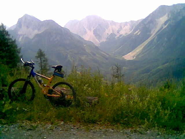
Von Feistritz/Rosental auf Asphalt ins "Bärental" Richtung "Klagenfurter Hütte", bei der "Stou Hütte" rechts auf Schotter weiter bergauf bis zum Ende des Forstweges. Dort Rad liegen lassen und zu Fuß ca. 200 HM steil bergauf bis zum Gipfel. Von dort wunderbare Aussicht über halb Kärnten. Beim Rückweg bei der "Kapelle" links---schöner downhill!

Abschließend noch eine Bitte an alle, die diese Tour nachgefahren sind: seid doch bitte so gut und schreibt als kleines danke schön für den download eure Erfahrung (Kritik)! Das hilft uns allen, die Tour aktuell zu alten! Danke und viel Spaß!
 

galéria trás

Mapa trasy a výškový profil

  • Open Street Map
  • Google
Minimum height 496 m Maximum height 1680 m Detailný pohľad

More about the tour author

wdefner
Member since 2004

Send private message

komentáre

ALPENCROSSER on 21.07.2011

Matschachergupf

Eine wirklich schöne und empfehlenswerte "kombinierte" Tour mit >Postkartenpanorama< am Gipfel! Die sehr steilen 215 HM Fußmarsch sollten nicht unterschätzt werden, Vorsicht am Rückweg - ein kleiner Ausrutscher ist da immer drinnen. Werde mir diese Tour sicherlich im Herbst nochmals geben - als Ersatz für die überlaufene Strecke zur Klagenfurter Hütte, eine echte Alternative !!
Danke Wolfram
Von Villach kommend: A2 Richtung Slowenien, Abfahrt: St.Jakob/Rosental, dann links Richtung Feistritz/Rosental. Von Klagenfurt kommend: Rosentalerstrasse stadtauswärts Richtung Loiblpass (Slowenien), nach der Draubrücke beim Kreisverkehr rechts abbiegen Richtung Feistritz/Rosental

GPS trasy

Trackpoints
  • GPX / Garmin Map Source (gpx) download
  • TCX / Garmin Training Center® (tcx) download
  • CRS / Garmin Training Center® (crs) download
  • Google Earth (kml) download
  • G7ToWin (g7t) download
  • TTQV (trk) download
  • Overlay (ovl) download
  • Fugawi (txt) download
  • Kompass (DAV) Track (tk) download
  • list trasy (pdf) download
  • Original file of the author (gpx) download

More about the tour author

wdefner
Member since 2004

Send private message
Share track
Add to my favorites
Remove from my favorites
Edit tags
My score
Rate
trasa: Matschacher Gupf
Druh: horský bicykel
Dĺžka: 28,8 km
Evaluated on:
Doba:
Day(s)
Hour(s)
Minute(s)
ohodnotenie: Kraj pôžitok z túry kondícia technika