Login

Zabudli ste prihlasovacia meno

Cookies have to be accepted!
Your browser's cookie functionality is disabled. Please enable this functionality.

Not a member yet?

Register now
Login

Available for registred users only

Log in to use this feature.

Zabudli ste prihlasovacia meno

Cookies have to be accepted!
Your browser's cookie functionality is disabled. Please enable this functionality.

Not a member yet?

Register now
Filter
Kategórie
Advanced filters
  • Dĺžka (km)
  • výškomer
Uložiť filter Reset filter

TrackRank

QRCode

Technical data

Dĺžka20,5 km výškomer369 m Way down370 m Doba01:50 h:m dátum19.05.2010
ohodnotenia Author Kraj pôžitok z túry kondícia technika

štatistika

751 náhľady ohodnotenia 155 Stiahnutia priemer
Rate
  • list trasy
  • príjazd
  • Stiahnutia

Entspannte Tour erst auf Asphalt dann Schotterwege und angelegte MTB-Pisten

Gestartet wird am Campingplatz Mare Pineta in Sistiana.Der Platz ist zu empfelen,zumindest als wir im Juni 08 dort waren "Vorsaison ".Von hier aus kann man viel unternehmen zb. Grottenbesuch Stadtbummel in Triest ,Schloß Duino,Wandern,Baden usw.   Und natürlich Biken!

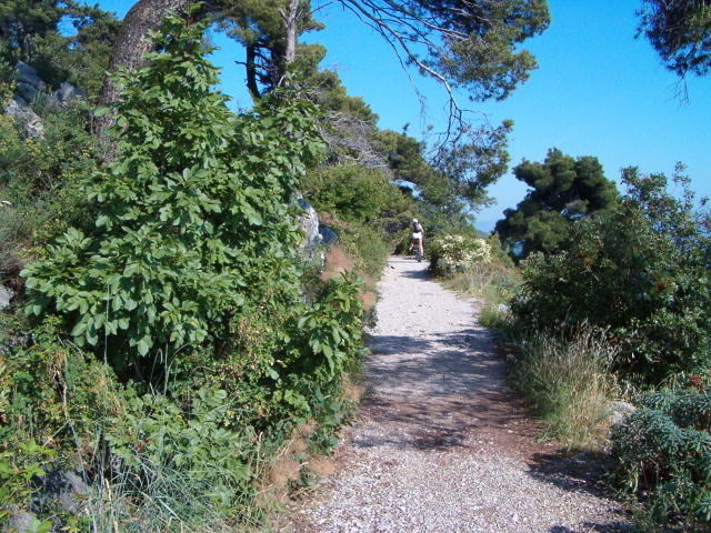
Nun zurück zur Tour. Wir fahren auf Asphalt bergauf bis Malchina.Ab hier geht es dann weiter auf Karstwegen durch die sehr grüne wenig bewohnte Hügellandschaft.Kurze Anstiege und Abfahten wechseln einander ab.Vorbei an einigen verstreut gelegenen Gehöften erreichen wir dann wieder den Ort Malchina. Von hier aus dann dem selben Weg wei schon bei der Auffahrt ,in zügiger Fahrt "sehr angenehm im Sommer" hinab zum Campingplatz. Oder gleich runter ans Meer zum Abkühlen.

galéria trás

Mapa trasy a výškový profil

  • Open Street Map
  • Google
Minimum height 52 m Maximum height 217 m Detailný pohľad

More about the tour author

Dropper
Member since 2009

Send private message

komentáre

A4 Venezia-Triest Ausfahrt Sistiana

GPS trasy

Trackpoints
  • GPX / Garmin Map Source (gpx) download
  • TCX / Garmin Training Center® (tcx) download
  • CRS / Garmin Training Center® (crs) download
  • Google Earth (kml) download
  • G7ToWin (g7t) download
  • TTQV (trk) download
  • Overlay (ovl) download
  • Fugawi (txt) download
  • Kompass (DAV) Track (tk) download
  • list trasy (pdf) download
  • Original file of the author (gpx) download

More about the tour author

Dropper
Member since 2009

Send private message
Share track
Add to my favorites
Remove from my favorites
Edit tags
My score
Rate
trasa: Karstrunde zur Slovenischen Grenze
Druh: horský bicykel
Dĺžka: 20,5 km
Evaluated on:
Doba:
Day(s)
Hour(s)
Minute(s)
ohodnotenie: Kraj pôžitok z túry kondícia technika