Login

Zabudli ste prihlasovacia meno

Cookies have to be accepted!
Your browser's cookie functionality is disabled. Please enable this functionality.

Not a member yet?

Register now
Login

Available for registred users only

Log in to use this feature.

Zabudli ste prihlasovacia meno

Cookies have to be accepted!
Your browser's cookie functionality is disabled. Please enable this functionality.

Not a member yet?

Register now
Filter
Kategórie
Advanced filters
  • Dĺžka (km)
  • výškomer
Uložiť filter Reset filter

TrackRank

QRCode

Technical data

Dĺžka16,3 km výškomer880 m Way down857 m Doba05:00 h:m dátum31.05.2010
ohodnotenia Author Kraj pôžitok z túry kondícia technika

štatistika

665 náhľady ohodnotenia 96 Stiahnutia priemer
Rate
  • list trasy
  • príjazd
  • Stiahnutia

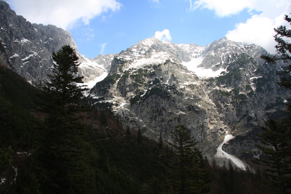
Von Scheffau aus gehts auf Aspahlt zum Parkplatz der Wegscheidalm. Dann über Wegscheidalm Kaiseralm zum Gruttenweg. Immer leicht bergauf-berab mit grandiosen Ausblicken zu den Kaisergipfeln und spektukuläre Sicht zur Gruttenhütte  bevor es wieder talwärts geht. Schöne Einkehrmöglichkeiten bei der Riedl Hütte oder bei Leo.

Auf gut markierten Wegen teils auf Asphalt zurück nach Scheffau.


galéria trás

Mapa trasy a výškový profil

  • Open Street Map
  • Google
Minimum height 699 m Maximum height 1459 m Detailný pohľad

More about the tour author

winfried_manke
Member since 2009

Send private message

komentáre

GPS trasy

Trackpoints
  • GPX / Garmin Map Source (gpx) download
  • TCX / Garmin Training Center® (tcx) download
  • CRS / Garmin Training Center® (crs) download
  • Google Earth (kml) download
  • G7ToWin (g7t) download
  • TTQV (trk) download
  • Overlay (ovl) download
  • Fugawi (txt) download
  • Kompass (DAV) Track (tk) download
  • list trasy (pdf) download
  • Original file of the author (gpx) download

More about the tour author

winfried_manke
Member since 2009

Send private message
Share track
Add to my favorites
Remove from my favorites
Edit tags
My score
Rate
trasa: Rundwanderung am Fusse des Wilden Kaisers
Druh: horská trasa
Dĺžka: 16,3 km
Evaluated on:
Doba:
Day(s)
Hour(s)
Minute(s)
ohodnotenie: Kraj pôžitok z túry kondícia technika