Login

Zabudli ste prihlasovacia meno

Cookies have to be accepted!
Your browser's cookie functionality is disabled. Please enable this functionality.

Not a member yet?

Register now
Login

Available for registred users only

Log in to use this feature.

Zabudli ste prihlasovacia meno

Cookies have to be accepted!
Your browser's cookie functionality is disabled. Please enable this functionality.

Not a member yet?

Register now
Filter
Kategórie
Advanced filters
  • Dĺžka (km)
  • výškomer
Uložiť filter Reset filter

TrackRank

QRCode

Technical data

Dĺžka50,0 km výškomer804 m Way down816 m Doba05:00 h:m dátum09.06.2010
ohodnotenia Author Kraj pôžitok z túry kondícia technika

štatistika

2487 náhľady 1 ohodnotenie 293 Stiahnutia 4.00 priemer
Rate
  • list trasy
  • príjazd
  • Stiahnutia

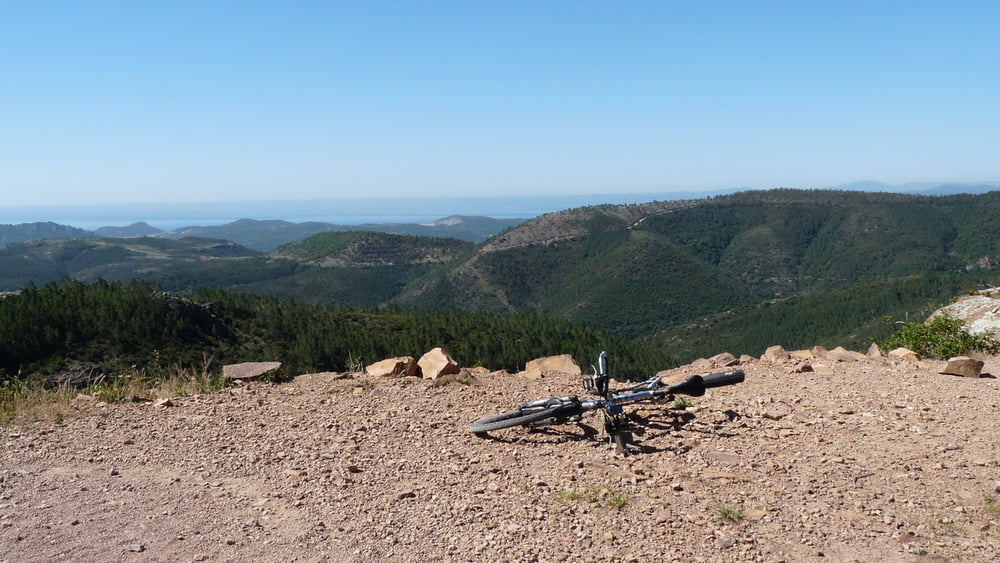
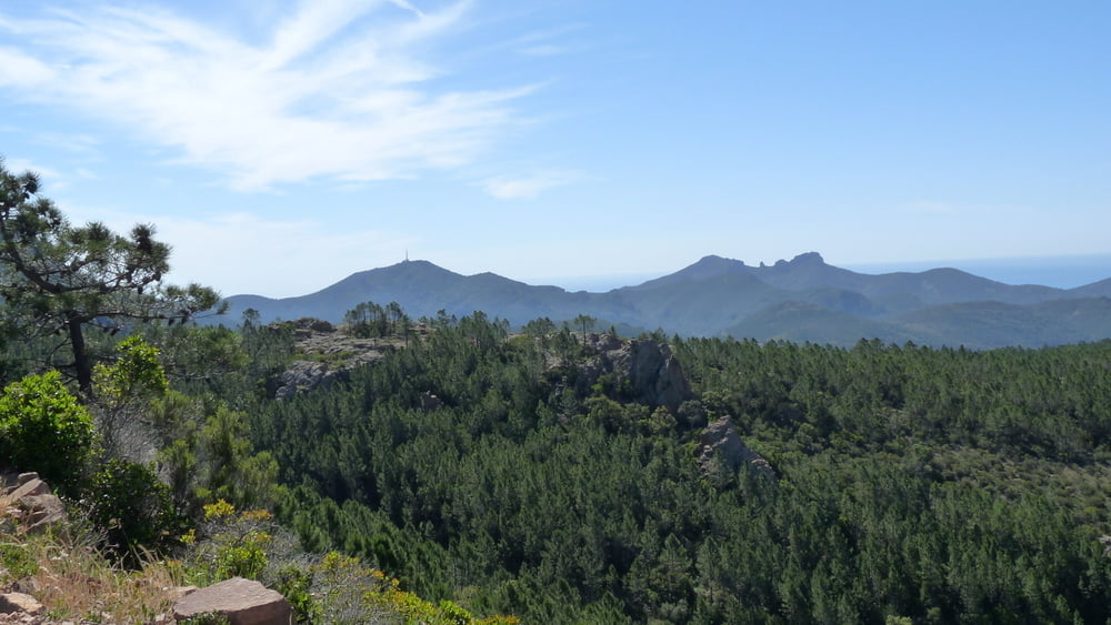
Ausgangspunkt dieser größeren Rundfahrt durch das Esterel-Gebirge ist der Campingplatz am Cap Dramont. Zunächst geht es auf Asphalt zum Esterel Caravaning und dann auf unbefestigten Wegen bis zum Col Des Trois Termes. Ab hier auf der Teerstraße eine schöne gemütliche Abfahrt bis Agay.

Auf der ganzen Strecke bietet sich eine herrliche Aussicht über das Esterelgebirge und die Küste von Cannes bis St. Raphael. Als Abstecher ist zusätzlich die Auffahrt auf den Mont Vinaigre möglich.

Sollten Sie die Tour im Frühjahr antreten, bieten sich kurz nach dem Maison Forestiere De La Duchesse und zum Tourende am Le Grenouillet  Badegelegenheiten.

galéria trás

Mapa trasy a výškový profil

  • Open Street Map
  • Google
Minimum height 2 m Maximum height 464 m Detailný pohľad

More about the tour author

drmayr
Member since 2008

Send private message

komentáre

Trepur on 03.09.2010

Sehr schöne Tour

Die Tour verläuft sehr schön durchs Esterel - großteils auf geschotterten Wanderwegen. Die Anstiege sind moderat und leicht fahrbar. So stellt man sich "Soulbiken" vor ...

GPS trasy

Trackpoints
  • GPX / Garmin Map Source (gpx) download
  • TCX / Garmin Training Center® (tcx) download
  • CRS / Garmin Training Center® (crs) download
  • Google Earth (kml) download
  • G7ToWin (g7t) download
  • TTQV (trk) download
  • Overlay (ovl) download
  • Fugawi (txt) download
  • Kompass (DAV) Track (tk) download
  • list trasy (pdf) download
  • Original file of the author (gpx) download

More about the tour author

drmayr
Member since 2008

Send private message
Share track
Add to my favorites
Remove from my favorites
Edit tags
My score
Rate
trasa: Größere Runde im Esterel
Druh: horský bicykel
Dĺžka: 50,0 km
Evaluated on:
Doba:
Day(s)
Hour(s)
Minute(s)
ohodnotenie: Kraj pôžitok z túry kondícia technika