


Eine schöne Tageswanderung mit herrlichen Aussichten, nicht nur vom Gipfel.
Von unserem Startpunkt Pension Adlerhorst geht es entlang der Ramsauer Ache zur Pfeifenmacherbrücke. Hier gibt es auch einen Wanderparkplatz.
Weiter geht es auf gut beschilderten Wegen zur 1359m hoch gelegenen Schärtenalm. Nach einer Rast folgt der Anstieg über Stufen zur 1680m hoch gelegenen Blaueishütte.
Den hier selbstgebackenen Kuchen sollte man auf jeden Fall probieren.
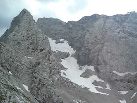
Man geht nun in Richtung Blaueisgletscher. Der Weg zur Schärtenspitze selbst ist ein Klettersteig, der mit Leitern und Stahlseilen gesichert ist. Ab hier ist Trittsicherheit und Schwindelfreiheit unbedingte Voraussetzung.
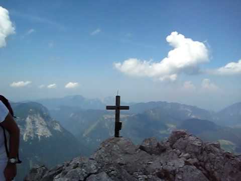
Auf dem Gipfel ist nicht viel Platz.
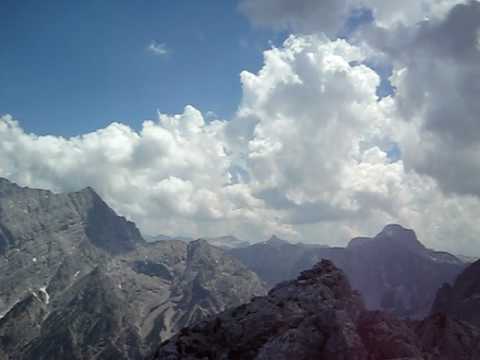
Den Rundblick habe ich in den youtube-videos festgehalten.
Weitere Fotos der Tour liegen unter:
picasaweb.google.de/uffehiker/2010_07_12_Ramsau_Schartenspitze
Further information at
http://www.blaueishuette.de/galéria trás


Mapa trasy a výškový profil
Minimum height 665 m
Maximum height 2136 m
More about the tour author
|
|
uffehiker |
komentáre

GPS trasy
Trackpoints-
GPX / Garmin Map Source (gpx) download
-
TCX / Garmin Training Center® (tcx) download
-
CRS / Garmin Training Center® (crs) download
-
Google Earth (kml) download
-
G7ToWin (g7t) download
-
TTQV (trk) download
-
Overlay (ovl) download
-
Fugawi (txt) download
-
Kompass (DAV) Track (tk) download
-
list trasy (pdf) download
-
Original file of the author (gpx) download
More about the tour author
|
|
uffehiker |
Add to my favorites
Remove from my favorites
Edit tags
Open track
My score
Rate