


Vierter Teil der Insel Losinj-Umrundung (zumindest vom südlichen Teil der Insel).
Ich habe die 4 Teile nach Schwierigkeitsgrad geordnet: 1 am einfachsten, 4 am schwierigsten.
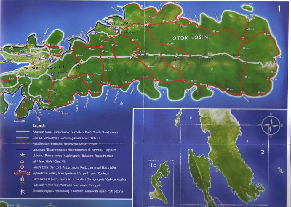
Die Tour führt von Mali Losinj auf der Asphaltstraße auf dem Bergrücken in der Mitte der Insel Richtung Süden. Von dieser Straße geht es dann auf einem Trail links bergab Richtung Veli Losinj, am Ende ziemlich Steil über Stufen. An der Kirche Sv. Nikola rechts ab auf einen Trail Richtung Kriska-Bucht. Von dort weiter zur Jamna-Bucht.
Ab jetzt wird es anstrengend, es muss viel bergauf geschoben werden. Irgendwann geht es aber auch wieder bergab (viel Geröll, teils schwierig zu fahren), bis man auf die Küste stößt. Weiter auf einem Pfad bis Mrtvaska.
250 hm Asphaltstraße hoch, dann wieder rechts ab auf einen steilen Trail bis nach Veli Losinj. Von dort gemütlich auf dem Beton-Spazierweg zurück nach Mali Losinj.
galéria trás


Mapa trasy a výškový profil
Minimum height -6 m
Maximum height 244 m
More about the tour author

|
Domingo |
komentáre

Start ist in Mali Losinj in der Nähe des großen Parkplatzes oberhalb der Tankstelle am Ende des Jachthafens (westliche Seite).
GPS trasy
Trackpoints-
GPX / Garmin Map Source (gpx) download
-
TCX / Garmin Training Center® (tcx) download
-
CRS / Garmin Training Center® (crs) download
-
Google Earth (kml) download
-
G7ToWin (g7t) download
-
TTQV (trk) download
-
Overlay (ovl) download
-
Fugawi (txt) download
-
Kompass (DAV) Track (tk) download
-
list trasy (pdf) download
-
Original file of the author (gpx) download
More about the tour author
|
|
Domingo |
Add to my favorites
Remove from my favorites
Edit tags
Open track
My score
Rate