
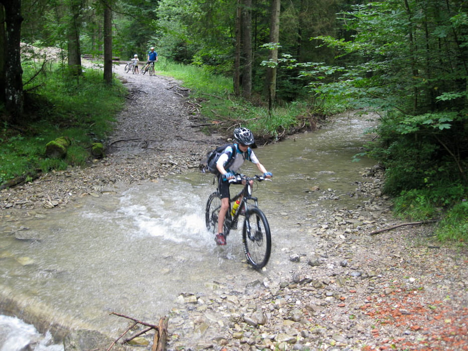

Ich habe hier eine kleine nette (familientaugliche) MTB-Tour. Von Hausham geht es erst Richtung Wörnsmühl. Alles ohne nennenswerte Anstiege, dafür aber mehrere Bachdurchfahrten. Unsere Kinder hatten viel Spaß dabei. Den kleinen Haken bei km 5,5 einfach ignorieren. Da haben wir uns kurz verfahren. Es geht bis Wörnsmühl immer am Rohrbach entlang, der dabei 3 mal durchfahren wird. In Wörnsmühl kommt man bei einem super Gasthof raus. Einkehren ist eigentlich Pflicht. Sonntags ist Schnitzeltag (5,50 Euro). Die Portion reicht locker für 2 Personen. Weiter geht es dann an der Leitzach Richtung Fischbachau. Von dort weiter Richtung B307 . Alles auf Forstwegen oder Nebenstraßen. An der B307 kann man in den Bodensee-Königssee Radweg einbiegen und auf der Westseite des Schliersees (Badestop nicht vergessen) zum Ausgangspunkt wieder zurück fahren.
Die bei Dauer angegebene Zeit ist die reine Fahrzeit, die wir mit unseren Kindern (8 und 10) gebraucht haben.
galéria trás


Mapa trasy a výškový profil
Minimum height 697 m
Maximum height 858 m
More about the tour author

|
mi_ec |
komentáre

GPS trasy
Trackpoints-
GPX / Garmin Map Source (gpx) download
-
TCX / Garmin Training Center® (tcx) download
-
CRS / Garmin Training Center® (crs) download
-
Google Earth (kml) download
-
G7ToWin (g7t) download
-
TTQV (trk) download
-
Overlay (ovl) download
-
Fugawi (txt) download
-
Kompass (DAV) Track (tk) download
-
list trasy (pdf) download
-
Original file of the author (gpx) download
More about the tour author
|
|
mi_ec |
Add to my favorites
Remove from my favorites
Edit tags
Open track
My score
Rate