


Altenberg (bei Königsberg) und Asslarer Wald (Lahn-Dill-Kreis).
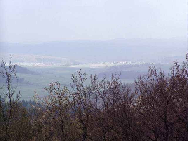
Vom Parkplatz aus lohnt ein Abstecher zum Turm auf dem Altenberg (Waypoint). Vom Turm aus hat man einen herrlichen Blick auf Königsberg und Umgebung.
Tipp:
Die Tour führt durch den Asslarer Steinbruch, daher kann dort an Werktagen reger Baustellen/Lkw-Verkehr herrschen.
In diesem Fall sollte man nicht durch den Steinbruch fahren, sondern lieber folgenden Umweg nehmen:
auf dem Schotterweg weiter bis zur Autobahn fahren. Vor dem Tunnel links die Teerstraße Richtung Steinbruch fahren, vor dem Steinbruch kommt man wieder auf die GPS-Strecke.
Herzlichen Dank an Gerd Poschta (www.radfotos.de), der die Fotos zur Verfügung gestellt hat.
galéria trás
Mapa trasy a výškový profil
Minimum height 230 m
Maximum height 416 m
More about the tour author

|
komentáre
gpstour56
on 10.03.2007
Einfach Klasse

Gestartet wird am Parkplatz am Altenberg an der L3053 zwischen Königsberg und Blasbach.
GPS trasy
Trackpoints-
GPX / Garmin Map Source (gpx) download
-
TCX / Garmin Training Center® (tcx) download
-
CRS / Garmin Training Center® (crs) download
-
Google Earth (kml) download
-
G7ToWin (g7t) download
-
TTQV (trk) download
-
Overlay (ovl) download
-
Fugawi (txt) download
-
Kompass (DAV) Track (tk) download
-
list trasy (pdf) download
-
Original file of the author (gpx) download
More about the tour author
|
|
Add to my favorites
Remove from my favorites
Edit tags
Open track
My score
Rate