


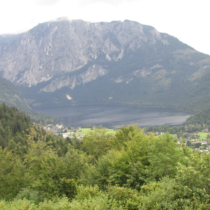
Links vom Hotel Tyrol die Asphaltstrasse hoch der Beschilderung Wasserfall/Ruine Pflindsberg folgen. Der Weg führt über den Graben des Trattenbaches zum 100 m hohen Wasserfall und weiter zur Ruine Pflindsberg (wobei "Ruine" für die zwei Mauern etwas übertrieben ist), von wo man einen schönen Blick zum Altaussee hat. Man folgt dann der Beschilderung Sarsteinblick und wandert anschließend auf dem Moosberg zum Salzbergwerk (Besichtigung zu jeder vollen Stunde möglich, auch Einkehr möglich)
Unmittelbar unterhalb des Parkplatzes am Salzbergwerk führt eine Schotterstrasse abwärts, der man folgt bis zu einer Aphaltstrasse, hier ein kurzes Stück weiter links abwärts, um auf dem Wiesenweg 2a zurück nach Altaussee zu gelangen
Further information at
http://www.salzwelten.at/galéria trás

Mapa trasy a výškový profil
Minimum height 718 m
Maximum height 1045 m
More about the tour author
|
|
Lanzarottl |
komentáre

es gibt genügend (kostenpflichtige) Parkplätze in Altaussee, von Bad Aussee kommend in Altaussee Richtung Zentrum folgen, man fährt automatisch auf das Hotel Tyrol zu, das als Anhaltspunkt dient, links vom Hotel führt der Weg entlang. Wir sind weiter Richtung Salzbergwerk gefahren, am Ortsende von Altaussee ist ein kleiner kostenloser Parkplatz
GPS trasy
Trackpoints-
GPX / Garmin Map Source (gpx) download
-
TCX / Garmin Training Center® (tcx) download
-
CRS / Garmin Training Center® (crs) download
-
Google Earth (kml) download
-
G7ToWin (g7t) download
-
TTQV (trk) download
-
Overlay (ovl) download
-
Fugawi (txt) download
-
Kompass (DAV) Track (tk) download
-
list trasy (pdf) download
-
Original file of the author (gpx) download
More about the tour author
|
|
Lanzarottl |
Add to my favorites
Remove from my favorites
Edit tags
Open track
My score
Rate