


Auffahrt auf asphaltierten Almwegen und unbefestigten Forststraßen. Keine Trails. Kaum Verkehr.
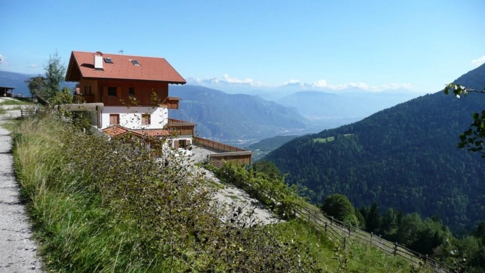
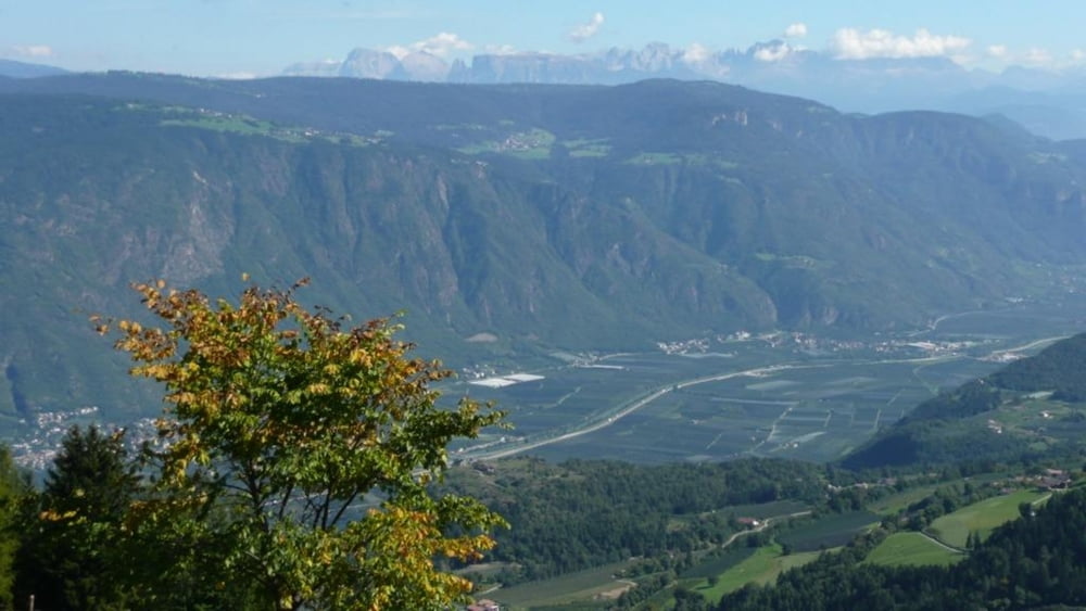
Zum Aufwärmen und um einen Überblick über Völlan zu bekommen, empfehle ich die kurze Tour an der Weggabelung rechts rauf zum Bauer am Stein. Ansonsten geht es links hoch Richtung Gruberhof / Gallhof. Der Wanderweg 4 kreuzt die Auffahrt häufig und bietet eine weitere Orientierungshilfe. Am Gallhof angelangt bietet sich eine erste Einkehr / Rast (erst anfragen ob geöffnet). Ab hier geht es auf schönen Forststraßen hoch zur Jägerhütte und weiter bis zum Völlaner Joch (1.638 m). Der Rückweg ist ein reiner "track back" mit tollen Ausblicken auf den Pawigl bzw. St. Pangratz, Meran, Völlan und Bozen. Bei guter Sicht zeigen sich die Dolomiten allen voran mit Schlern, Plattkofel, Sella bis zum Rosengarten.
galéria trás


Mapa trasy a výškový profil
Minimum height 705 m
Maximum height 1636 m
More about the tour author
|
|
charly60 |
komentáre

Von Lana in Richtung Gampenpass, dann nach Völlan.
Start-/ Zielpunkt: öffentlicher Parkplatz Kastanienweg bzw. an der Kirche Völlan, vor dem Hotel Völlanerhof.
GPS trasy
Trackpoints-
GPX / Garmin Map Source (gpx) download
-
TCX / Garmin Training Center® (tcx) download
-
CRS / Garmin Training Center® (crs) download
-
Google Earth (kml) download
-
G7ToWin (g7t) download
-
TTQV (trk) download
-
Overlay (ovl) download
-
Fugawi (txt) download
-
Kompass (DAV) Track (tk) download
-
list trasy (pdf) download
-
Original file of the author (gpx) download
More about the tour author
|
|
charly60 |
Add to my favorites
Remove from my favorites
Edit tags
Open track
My score
Rate