Login

Zabudli ste prihlasovacia meno

Cookies have to be accepted!
Your browser's cookie functionality is disabled. Please enable this functionality.

Not a member yet?

Register now
Login

Available for registred users only

Log in to use this feature.

Zabudli ste prihlasovacia meno

Cookies have to be accepted!
Your browser's cookie functionality is disabled. Please enable this functionality.

Not a member yet?

Register now
Filter
Kategórie
Advanced filters
  • Dĺžka (km)
  • výškomer
Uložiť filter Reset filter

TrackRank

QRCode

Technical data

Dĺžka39,1 km výškomer703 m Way down686 m Doba04:00 h:m dátum23.10.2010
ohodnotenia Author Kraj pôžitok z túry kondícia technika

štatistika

1186 náhľady ohodnotenia 318 Stiahnutia priemer
Rate
  • list trasy
  • príjazd
  • Stiahnutia

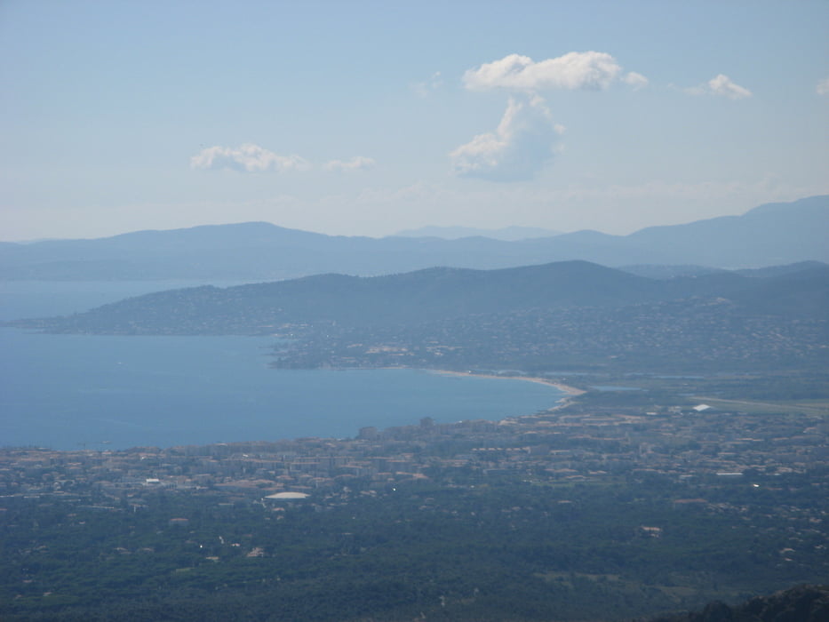
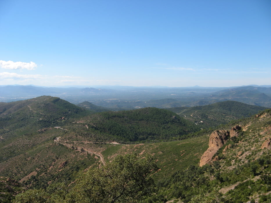
Landschaftlich sehr schöne Runde durch den Esterel. Tolle Aussichten, schöne Pisten.

Von Agay (Camping Agay-Soleil ist sehr empfehlenswert) über Strassse nach Valescure, rechts in GR 49 zum Mt.Vinaigre, zurück über Piste des Perthus.Technisch alles machbar, aber immer obacht! Der lose Schotter ist tückisch !!

galéria trás

Mapa trasy a výškový profil

  • Open Street Map
  • Google
Minimum height -13 m Maximum height 586 m Detailný pohľad

More about the tour author

hausmuell
Member since 2006

Send private message

komentáre

Über Autobahn A7, richtung Marseilles, dann Richtung Nizza, Ausfahrt Frejus-St. Raphael, dann nach Valescure, Agay

GPS trasy

Trackpoints
  • GPX / Garmin Map Source (gpx) download
  • TCX / Garmin Training Center® (tcx) download
  • CRS / Garmin Training Center® (crs) download
  • Google Earth (kml) download
  • G7ToWin (g7t) download
  • TTQV (trk) download
  • Overlay (ovl) download
  • Fugawi (txt) download
  • Kompass (DAV) Track (tk) download
  • list trasy (pdf) download
  • Original file of the author (gpx) download

More about the tour author

hausmuell
Member since 2006

Send private message
Share track
Add to my favorites
Remove from my favorites
Edit tags
My score
Rate
trasa: Esterel - Runde zum Mt. Vinaigre
Druh: horský bicykel
Dĺžka: 39,1 km
Evaluated on:
Doba:
Day(s)
Hour(s)
Minute(s)
ohodnotenie: Kraj pôžitok z túry kondícia technika