
")

Anspruchsvolle Tour auf beiden Talseiten mit vielen spassigen Trails.
Start in Küblis Marktplatz (Parkplätze vorhanden)
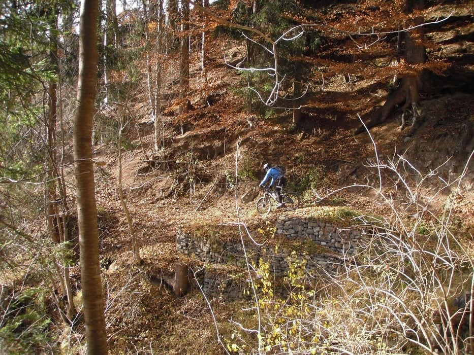
Asphaltierte Strasse nach Conters, dann sehr steile Rampe mitten durch Ortskern hinauf. Weiter auf Bergstrasse (teils Asphalt) zum Schiefer hinauf auf 1567 m Höhe, Berghaus und Liftstation, während der Saison bewirtschaftet. Weiter auf trailigem Waldweg rauf/runter (Brücken,Bäche und Wurzeln) zur Serneuser Schwendi. 150 m der Forststrasse entlang geht es links in einen super flowigen Waldtrail S1 - S2 (600 hm) nach Serneus hinunter. Dann Schlaufe zur imposanten Sunnibergbrücke (Name der Tour). Zuerst von oben dann von unten zu bestaunen. Zurück nach Serneus, kurze Steigung zur Kantonsstrasse hinauf, nach ca. 1 km rechts parallel zur Strasse eine Stützmauer hinauf, in einen stark verwachsenen Trail zur Strasse Richtung Alp Meder. Dann ca 900 hm hinaufkurbeln (moderate Steigung) bis zum höchsten Punkt dieser Tour auf 2000 Meter Höhe. Es folgt eine Abfahrt über einen alten verfallenen Alpweg, leicht verblockt und steil hinunter zum Speichersee Pläviggin. Zum Finale folgt die Geissgasse (sehr steiler Pfad) bis zum Ausgangspunkt.
Viel Spass beim Nachfahren!
galéria trás


Mapa trasy a výškový profil
Minimum height 767 m
Maximum height 1946 m
More about the tour author
|
|
hsn934 |
komentáre

GPS trasy
Trackpoints-
GPX / Garmin Map Source (gpx) download
-
TCX / Garmin Training Center® (tcx) download
-
CRS / Garmin Training Center® (crs) download
-
Google Earth (kml) download
-
G7ToWin (g7t) download
-
TTQV (trk) download
-
Overlay (ovl) download
-
Fugawi (txt) download
-
Kompass (DAV) Track (tk) download
-
list trasy (pdf) download
-
Original file of the author (gpx) download
More about the tour author
|
|
hsn934 |
Add to my favorites
Remove from my favorites
Edit tags
Open track
My score
Rate