


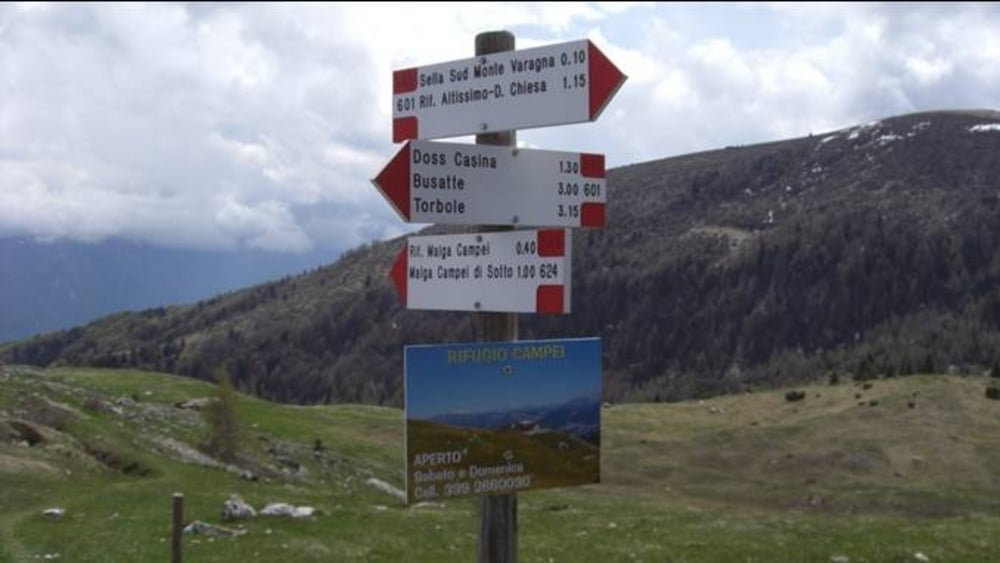
Eine einfache Variante den Altissimo zu erklimmen, ist die Kombination aus Autofahrt und Wanderung.
Der Startpunkt der Tour ist in Torbole an der Sarcabrücke. Mit dem Auto geht die Fahrt über Via Europe nach Nago und dann die Monte Baldo Straße hinauf, bis auf ca. 1500m (ab hier ist die Straße für PKW gesperrt).
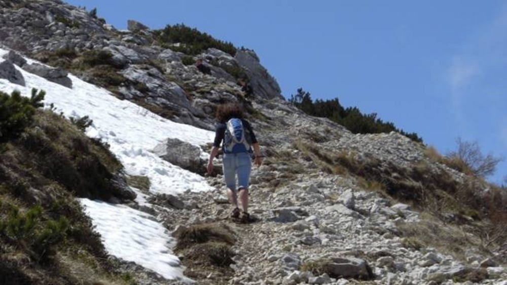
Die letzten 600 Höhenmeter werden jetzt zu Fuß absolviert und man hat so ausreichend Zeit die vielen Eindrücke zu genießen.
Further information at
http://www.Schliesser-Bike.degaléria trás
Mapa trasy a výškový profil
Minimum height 1522 m
Maximum height 2084 m
More about the tour author
|
|
mtb-tom |
komentáre

GPS trasy
Trackpoints-
GPX / Garmin Map Source (gpx) download
-
TCX / Garmin Training Center® (tcx) download
-
CRS / Garmin Training Center® (crs) download
-
Google Earth (kml) download
-
G7ToWin (g7t) download
-
TTQV (trk) download
-
Overlay (ovl) download
-
Fugawi (txt) download
-
Kompass (DAV) Track (tk) download
-
list trasy (pdf) download
-
Original file of the author (gpx) download
More about the tour author
|
|
mtb-tom |
Add to my favorites
Remove from my favorites
Edit tags
Open track
My score
Rate