
)")

Wangen-Leutkirch-Isny-Wangen
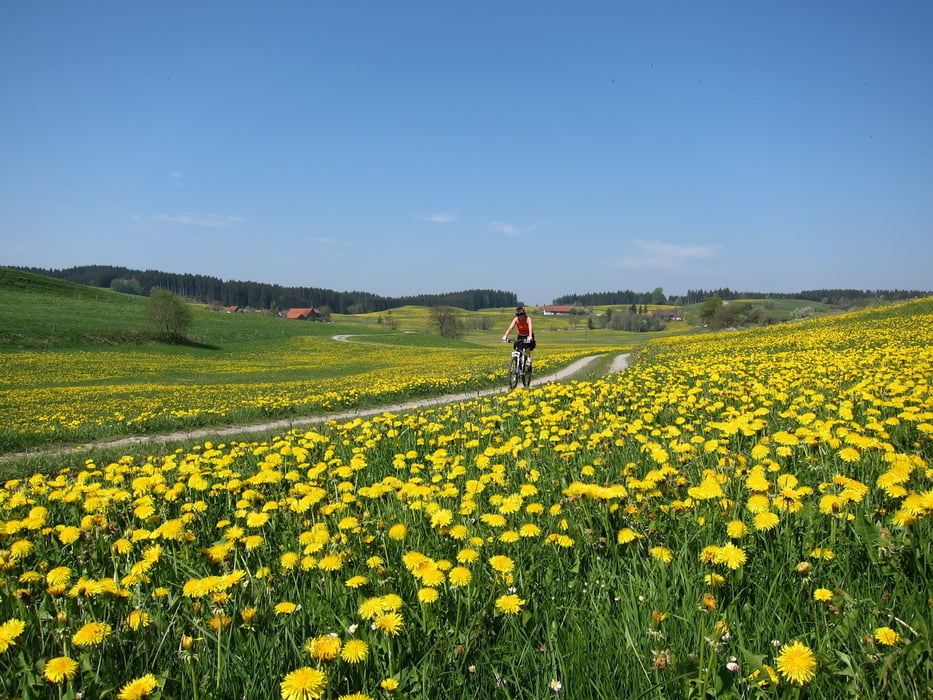
Sehr schöne abwechslungsreiche Trekkingbike Tour durch`s Allgäu mit kleinen Mountainbike Passagen. Alles fahrbar!
Wegbeschaffenheit: ca. 70% auf verkehrsarme Teerstraßen, die restlichen 30% teilen sich mit Wald, Wiesen und Schotterwegen auf.
Wegstrecke: Wir starten vom Parkplatz P14 in Wangen Richtung Durrenberg - Deuchelried - Zuwies - Ratzenried - Buchen - Berfallen - Schwenden - Meggen - Au - Merazhofen - Engelboldshofen - Engerazhofen - Toberazhofen - Bettelhofen - Herlazhofen - kurz vor Leutkirch, biegen wir rechts ab nach Öschhöfe - Urlau - Boschen - Aigeltshofen - Furtenwise - Isny - Boden - Eisenharz - Gießen - Epplings - Wangen zum Parkplatz.
Further information at
http://de.wikipedia.org/wiki/Wangen_im_Allg%C3%A4ugaléria trás


Mapa trasy a výškový profil
Minimum height 550 m
Maximum height 733 m
More about the tour author
|
|
W-C |
komentáre
Parkplatz:
In Wangen, nähe Gallusbrücke (Argencenter), auf dem Parkplatz P14 (Scherrichmühlweg). Das Parken ist gebührenfrei.
Parkplatz - Koordinaten für dein Navigationsgerät
N 47° 41. 235´
E 9° 50. 343´
GPS trasy
Trackpoints-
GPX / Garmin Map Source (gpx) download
-
TCX / Garmin Training Center® (tcx) download
-
CRS / Garmin Training Center® (crs) download
-
Google Earth (kml) download
-
G7ToWin (g7t) download
-
TTQV (trk) download
-
Overlay (ovl) download
-
Fugawi (txt) download
-
Kompass (DAV) Track (tk) download
-
list trasy (pdf) download
-
Original file of the author (gpx) download
More about the tour author
|
|
W-C |
Add to my favorites
Remove from my favorites
Edit tags
Open track
My score
Rate
Wangen Leutkirch-Isny
Wir sind die Tour am 3.10.2011 gefahren. Hat super Spass gemacht, Beschreibung und Aufzeichnung sind zutreffend. Ich bin mit MTB mein Kollege mit Treckingrad gefahren, der hatte manchmal mit (groben) Schotter seine Mühe aber auch er war am Schluss begeistert von der Tour. mfg. Huti