Login

Zabudli ste prihlasovacia meno

Cookies have to be accepted!
Your browser's cookie functionality is disabled. Please enable this functionality.

Not a member yet?

Register now
Login

Available for registred users only

Log in to use this feature.

Zabudli ste prihlasovacia meno

Cookies have to be accepted!
Your browser's cookie functionality is disabled. Please enable this functionality.

Not a member yet?

Register now
Filter
Kategórie
Advanced filters
  • Dĺžka (km)
  • výškomer
Uložiť filter Reset filter

TrackRank

QRCode

Technical data

Dĺžka97,9 km výškomer866 m Way down873 m Doba03:40 h:m dátum25.04.2011
ohodnotenia Author User Kraj pôžitok z túry kondícia technika

štatistika

640 náhľady 1 ohodnotenie 86 Stiahnutia 4.00 priemer
Rate
  • list trasy
  • príjazd
  • Stiahnutia

In Nord-Südrichtung durchs Wittelsbacher Land

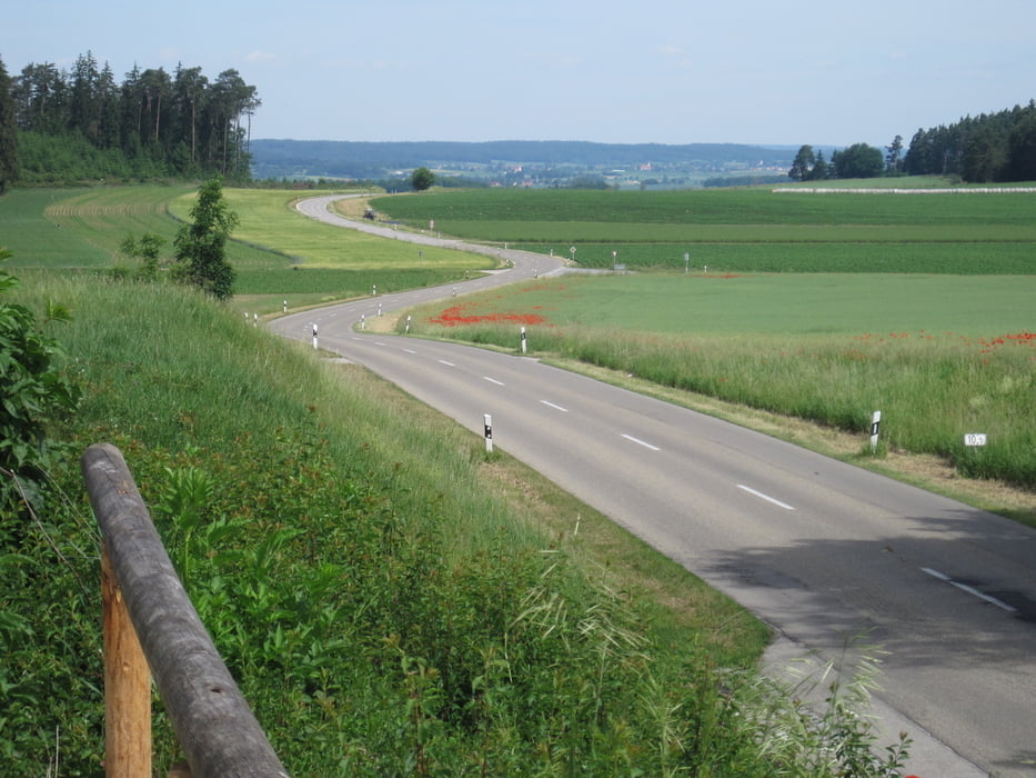
Fast durchwegs sehr verkehrsarme und schöne, kleine Nebenstraßen durch das Wittelsbacher Land um Aichach. Sehr ansprechende hügelige Landschaft die immer wieder schöne Weitsichten übers Land bietet.
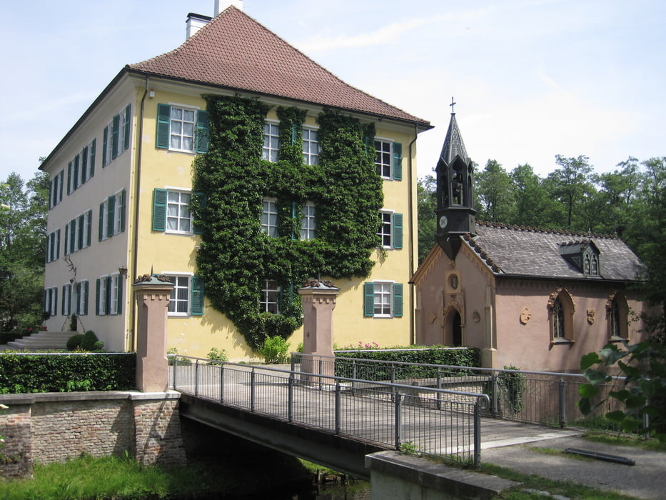
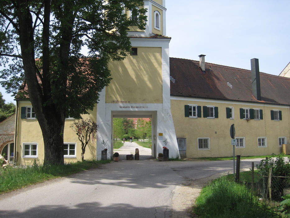
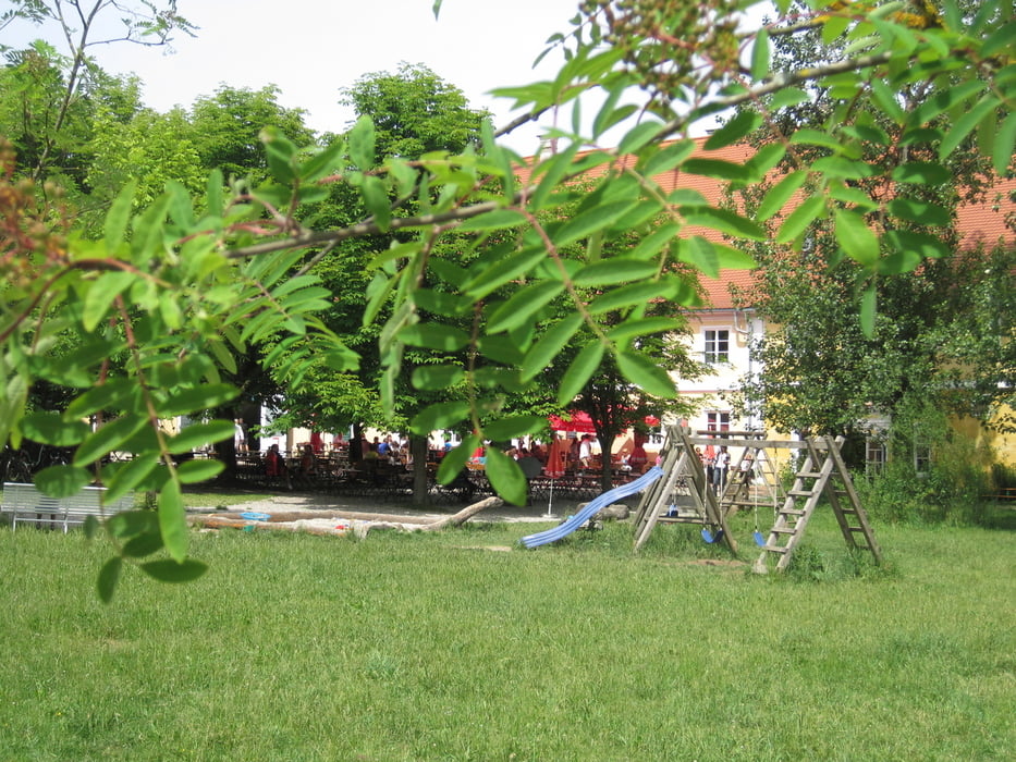
In Unterwittelsbach passiert man das Sisi-Schloss, die Wiege der bayrischen Wittelsbacher. Ein weiteres Schloss in Blumenthal bietet eine schöne Einkehrmöglichkeit im dortigen Biergarten.

galéria trás

Mapa trasy a výškový profil

  • Open Street Map
  • Google
Minimum height 388 m Maximum height 535 m Detailný pohľad

More about the tour author

Phlox_1
Member since 2010

Send private message

komentáre

raceklaus on 12.08.2012

Schöne tour

Habe die Tour ab Augsburg durchgeführt, schön mal nach Norden zu fahren. die Strecke ab Blumenthal war mir völlig unbekannt, schöne kurze knackige Steigungen.
Malcom on 11.08.2014

Super Tour

Tolle Tour auf kleinen Nebenstraßen. Landschaftlich wunderschön. Mit ein paar hübsch-knackigen Steigungen. Bin die Tour von Augsburg aus geafahren, so dass noch ein paar km oben drauf kamen.
Die Tour ist unbedingt empfehlenswert.
Da es sich um einen Rundkurs handelt kann man praktisch an jedem beliebigen Punkt einsteigen. 

GPS trasy

Trackpoints
  • GPX / Garmin Map Source (gpx) download
  • TCX / Garmin Training Center® (tcx) download
  • CRS / Garmin Training Center® (crs) download
  • Google Earth (kml) download
  • G7ToWin (g7t) download
  • TTQV (trk) download
  • Overlay (ovl) download
  • Fugawi (txt) download
  • Kompass (DAV) Track (tk) download
  • list trasy (pdf) download
  • Original file of the author (gpx) download

More about the tour author

Phlox_1
Member since 2010

Send private message
Share track
Add to my favorites
Remove from my favorites
Edit tags
My score
Rate
trasa: Kissing-Pöttmes-Aichach-Kissing
Druh: pretekársky bicykel
Dĺžka: 97,9 km
Evaluated on:
Doba:
Day(s)
Hour(s)
Minute(s)
ohodnotenie: Kraj pôžitok z túry kondícia technika