
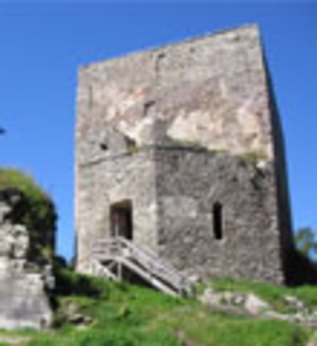

Diese grenzüberschreitende Tour bringt Sie zur Ruine Wittinghausen in Tschechien, die Adalbert Stifter in seinem Werk „Hochwald“ beschrieben hat.
„Ein grauer, viereckiger Turm steht auf grünem Weidegrund, von schweigendem, zerfallenem Außenwerk umgeben,...“
Von hier können Sie den herrlichen Blick über den Böhmerwald und den Moldaustausee genießen!
Ausgangspunkt dieser Tour ist Marktplatz Haslach an der Mühl.
Weg Nr. 805
Fordern Sie unsere Radkarte um EUR 3,00 hier an: info@boehmerwald.at!
Oder rufen Sie uns einfach an: Infotelefon +43 5 7890 100.
NEU: Elektrobikes im Verleih von Mai bis Oktober!
Further information at
http://www.boehmerwald.atgaléria trás

Mapa trasy a výškový profil
Minimum height 498 m
Maximum height 986 m
More about the tour author
|
|
aigen-schlaegl |
komentáre

Mit dem Auto
ab Linz: B127 bis Rohrbach - Haslach
ab Passau: Grenzübergang Breitenberg - Klaffer - Ulrichsberg - Aigen im Mühlkreis - Haslach
ab Tschechien: Grenzübergang Zadni Zvonkova/Schöneben - Ulrichsberg - Aigen im Mühlkreis - Haslach
Mit der Bahn ab Linz-Mühlkreisbahnhof bis Bhf Aigen-Schlägl http://www.oebb.at
Mit dem Bus http://www.oebb.at
GPS trasy
Trackpoints-
GPX / Garmin Map Source (gpx) download
-
TCX / Garmin Training Center® (tcx) download
-
CRS / Garmin Training Center® (crs) download
-
Google Earth (kml) download
-
G7ToWin (g7t) download
-
TTQV (trk) download
-
Overlay (ovl) download
-
Fugawi (txt) download
-
Kompass (DAV) Track (tk) download
-
list trasy (pdf) download
-
Original file of the author (gpx) download
More about the tour author
|
|
aigen-schlaegl |
Add to my favorites
Remove from my favorites
Edit tags
Open track
My score
Rate