Login

Zabudli ste prihlasovacia meno

Cookies have to be accepted!
Your browser's cookie functionality is disabled. Please enable this functionality.

Not a member yet?

Register now
Login

Available for registred users only

Log in to use this feature.

Zabudli ste prihlasovacia meno

Cookies have to be accepted!
Your browser's cookie functionality is disabled. Please enable this functionality.

Not a member yet?

Register now
Filter
Kategórie
Advanced filters
  • Dĺžka (km)
  • výškomer
Uložiť filter Reset filter

TrackRank

QRCode

Technical data

Dĺžka38,7 km výškomer611 m Way down612 m Doba02:00 h:m dátum20.06.2011
ohodnotenia Author User Kraj pôžitok z túry kondícia technika

štatistika

562 náhľady 1 ohodnotenie 105 Stiahnutia 3.00 priemer
Rate
  • list trasy
  • príjazd
  • Stiahnutia

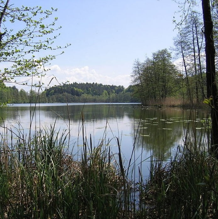
Tour von Tettnang aus zum Degersee/Schleinsee und weiter über Oberreitnau in Richtung Achberg. Hier drehen wir wieder Richtung Bodensee ab und fahren über Hiltensweiler und Laimnau zurück nach Tettnang. Die Tour ist angelehnt an Tour 68872.

Die Tour hat einen einfachen Schwierigkeitsgrad und lässt sich gut mit einem Hardtail fahren.


galéria trás

Mapa trasy a výškový profil

  • Open Street Map
  • Google
Minimum height 423 m Maximum height 563 m Detailný pohľad

More about the tour author

guemmer
Member since 2011

Send private message

komentáre

 Startpunkt ist der kleine Waldplatz zwischen Tettnang-Oberhof und Neuhäusle (Koordinaten: N47 39.485 E9 36.298)

GPS trasy

Trackpoints
  • GPX / Garmin Map Source (gpx) download
  • TCX / Garmin Training Center® (tcx) download
  • CRS / Garmin Training Center® (crs) download
  • Google Earth (kml) download
  • G7ToWin (g7t) download
  • TTQV (trk) download
  • Overlay (ovl) download
  • Fugawi (txt) download
  • Kompass (DAV) Track (tk) download
  • list trasy (pdf) download
  • Original file of the author (gpx) download

More about the tour author

guemmer
Member since 2011

Send private message
Share track
Add to my favorites
Remove from my favorites
Edit tags
My score
Rate
trasa: Bodenseehinterlandrunde
Druh: horský bicykel
Dĺžka: 38,7 km
Evaluated on:
Doba:
Day(s)
Hour(s)
Minute(s)
ohodnotenie: Kraj pôžitok z túry kondícia technika