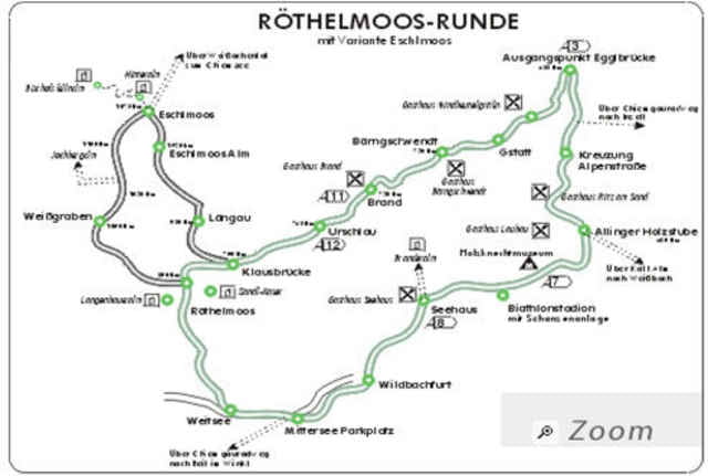
Von unserer Unterkunft dem Haus Pointner aus geht auf der Strasse Richtung Urschlau. An der Urschlauer Ache entlang am Abzweig links Richtung Röthelmoos Alm. Hier wechselt Teer auf Schotter und der Weg steigt deutlich an. Oben angekommen wollten wir die kleine Umfahrung Richtung Hammerer Graben wählen, aber das ist verflixt steil (schätze mehr als 20%) und haben dies dann abgebrochen.
Entlang dem Wappbach geht es so dahin und am Ende leicht berab bis zur B305.
Hier muss man rechts der Strasse entlang bis zum Parkplatz Seegatterl. Wer jetzt genug hat kann einen herrlichen Weg Richtung Ruhpolding wählen oder aber auch eine Schleife über die Winkelmoos Alm drehen.
Wir sind nicht direkt auf die Alm gefahren sondern um den Sondersberg herum und dann die Skiabfahrt hinunter. Achtung relativ steil auf Schotterautobahn.
Spätestens jetzt geht es an den Seen vorbei, am Biathlonzentrum vorbei und entlang der weissen Traun zurück.
[roland ehry, juni 2007]
Further information at
http://www.ruhpolding.deMapa trasy a výškový profil
Minimum height 653 m
Maximum height 1119 m
komentáre

GPS trasy
Trackpoints-
GPX / Garmin Map Source (gpx) download
-
TCX / Garmin Training Center® (tcx) download
-
CRS / Garmin Training Center® (crs) download
-
Google Earth (kml) download
-
G7ToWin (g7t) download
-
TTQV (trk) download
-
Overlay (ovl) download
-
Fugawi (txt) download
-
Kompass (DAV) Track (tk) download
-
list trasy (pdf) download
-
Original file of the author (gpx) download
Add to my favorites
Remove from my favorites
Edit tags
Open track
My score
Rate


