Login

Zabudli ste prihlasovacia meno

Cookies have to be accepted!
Your browser's cookie functionality is disabled. Please enable this functionality.

Not a member yet?

Register now
Login

Available for registred users only

Log in to use this feature.

Zabudli ste prihlasovacia meno

Cookies have to be accepted!
Your browser's cookie functionality is disabled. Please enable this functionality.

Not a member yet?

Register now
Filter
Kategórie
Advanced filters
  • Dĺžka (km)
  • výškomer
Uložiť filter Reset filter

TrackRank

QRCode

Technical data

Dĺžka48,2 km výškomer1972 m Way down1294 m Doba06:00 h:m dátum26.07.2011
ohodnotenia Author Kraj pôžitok z túry kondícia technika

štatistika

941 náhľady ohodnotenia 45 Stiahnutia priemer
Rate
  • list trasy
  • príjazd
  • Stiahnutia

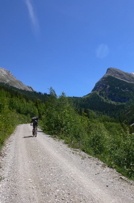
Dies Ist die erste Etappe meiner diesjährigen Transalp. Technisch nichts besonderes, landschaftlich ein traum.

Wir haben bei der Plumsjochhütte bivakiert und sind dann weiter zum Achensee. Diese tour lässt sich aber bestimmt in eine Karwendelrunde integrieren.

galéria trás

Mapa trasy a výškový profil

  • Open Street Map
  • Google
Minimum height 937 m Maximum height 1801 m Detailný pohľad

More about the tour author

ur-anus
Member since 2011

Send private message

komentáre

GPS trasy

Trackpoints
  • GPX / Garmin Map Source (gpx) download
  • TCX / Garmin Training Center® (tcx) download
  • CRS / Garmin Training Center® (crs) download
  • Google Earth (kml) download
  • G7ToWin (g7t) download
  • TTQV (trk) download
  • Overlay (ovl) download
  • Fugawi (txt) download
  • Kompass (DAV) Track (tk) download
  • list trasy (pdf) download
  • Original file of the author (gpx) download

More about the tour author

ur-anus
Member since 2011

Send private message
Share track
Add to my favorites
Remove from my favorites
Edit tags
My score
Rate
trasa: Scharnitz-Plumsjoch
Druh: horský bicykel
Dĺžka: 48,2 km
Evaluated on:
Doba:
Day(s)
Hour(s)
Minute(s)
ohodnotenie: Kraj pôžitok z túry kondícia technika