Ein tolles Lob den Organisatoren und den vielen Helfern für den 2007er Giro.
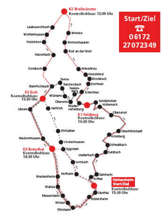
Eine mustergültig ausgeschilderte RTF, die uns so viel Spass machte, das wir die 150 km Runde drehten. Tolle Verpflegung an 4 Kontrollpunkten.
Nachdem wir den Vordertaunus mit seinen Ampelstopps hinter uns gelassen hatten, ging es von der Hohen Mark dem Feldberg hinauf. Schöne gleichmäßige Steigung mit Bergankunft.
Schnelle Abfahrt und dann mit unserer Lokomotive Ingo dem Weiltal entlang, schraubte den Schnitt auf 29 hoch.
Zurück durch den Taunus kostete allerdings an den vielen kleinen Anstiegen nicht nur den Schnitt, sondern auch einige Körner.
Zufrieden im Ziel konnte das bei Kuchen und Nudel aber wieder kompensiert werden.
Für die RSG Weilbach waren dabei: brigitte, stefanie, ingo, wolfgang, matthias, jürgen, klaus, ralf, roland, horst, erich, axel, georg
[roland ehry, juni 2007]
Further information at
http://www.rc-hattersheim.degaléria trás
Mapa trasy a výškový profil
Minimum height 80 m
Maximum height 874 m
komentáre

GPS trasy
Trackpoints-
GPX / Garmin Map Source (gpx) download
-
TCX / Garmin Training Center® (tcx) download
-
CRS / Garmin Training Center® (crs) download
-
Google Earth (kml) download
-
G7ToWin (g7t) download
-
TTQV (trk) download
-
Overlay (ovl) download
-
Fugawi (txt) download
-
Kompass (DAV) Track (tk) download
-
list trasy (pdf) download
-
Original file of the author (gpx) download
Add to my favorites
Remove from my favorites
Edit tags
Open track
My score
Rate


