


Langstreckenfahrt ("One-Way") um von Bonn nach Luxemburg zu gelangen.
Die Route führt häufig über Radwege, ist aber trotzdem sehr gut Rennrad tauglich. Folgende Radfernwege bilden dabei die Hauptachsen:
1. Ahr-Radweg: von Altenahr bis Ahrdorf (Nebenstraßen)
(teilweise Alternativstrecke, da der Radweg zwischen Dümpelfeld und Ahrdorf nicht immer geteert ist - für Tourenräder aber sehr gut geeignet)
2. Kylltalradweg: von Pelm bis Erdorf (Nebenstraßen)
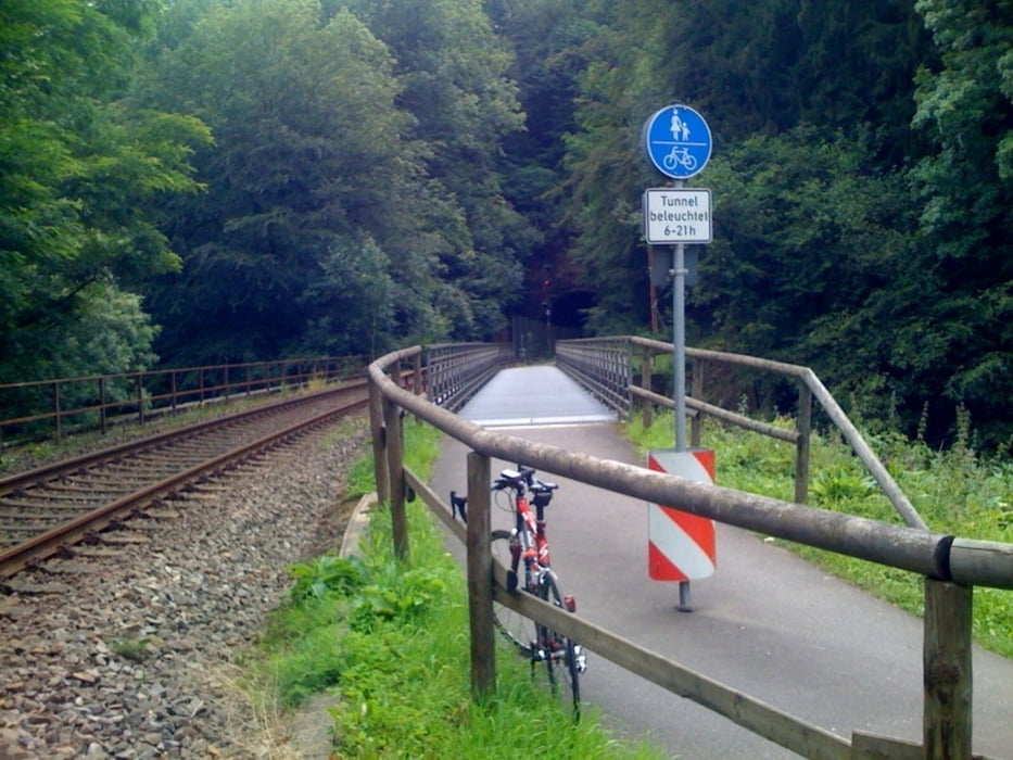
3. Nimstal-Radweg: von Erdorf bis Irrel (Nebenstraßen, alte Bahntrasse)
4. "Charly": von Echternach bis Luxemburg-Stadt (alte Bahntrasse)
Achtung: bei Regen ist dieser Radweg an den Steigungen durch die Luxemburger Schweiz teilweise etwas rutschig
Optimierungspotential:
* Schönere Strecke durch oder an Bitburg vorbei
Info: Die GPS-Aufzeichnung wude geringfügig manuell nachbearbeitet, um ein paar Irr- und Umwege zu korrigieren - ich hoffe, dass sich dabei keine Fehler eingeschlichen haben.
galéria trás


Mapa trasy a výškový profil
Minimum height 58 m
Maximum height 494 m
More about the tour author

|
velo_rouge |
komentáre

Start ist am Quirinusplatz in Dottendorf, anschließend geht es über den Venusberg aus Bonn heraus.
GPS trasy
Trackpoints-
GPX / Garmin Map Source (gpx) download
-
TCX / Garmin Training Center® (tcx) download
-
CRS / Garmin Training Center® (crs) download
-
Google Earth (kml) download
-
G7ToWin (g7t) download
-
TTQV (trk) download
-
Overlay (ovl) download
-
Fugawi (txt) download
-
Kompass (DAV) Track (tk) download
-
list trasy (pdf) download
-
Original file of the author (gpx) download
More about the tour author
|
|
velo_rouge |
Add to my favorites
Remove from my favorites
Edit tags
Open track
My score
Rate