Login

Zabudli ste prihlasovacia meno

Cookies have to be accepted!
Your browser's cookie functionality is disabled. Please enable this functionality.

Not a member yet?

Register now
Login

Available for registred users only

Log in to use this feature.

Zabudli ste prihlasovacia meno

Cookies have to be accepted!
Your browser's cookie functionality is disabled. Please enable this functionality.

Not a member yet?

Register now
Filter
Kategórie
Advanced filters
  • Dĺžka (km)
  • výškomer
Uložiť filter Reset filter

TrackRank

QRCode

Technical data

Dĺžka22,3 km výškomer974 m Way down985 m Doba02:00 h:m dátum11.09.2011
ohodnotenia Author User Kraj pôžitok z túry kondícia technika

štatistika

593 náhľady 1 ohodnotenie 69 Stiahnutia 3.00 priemer
Rate
  • list trasy
  • príjazd
  • Stiahnutia

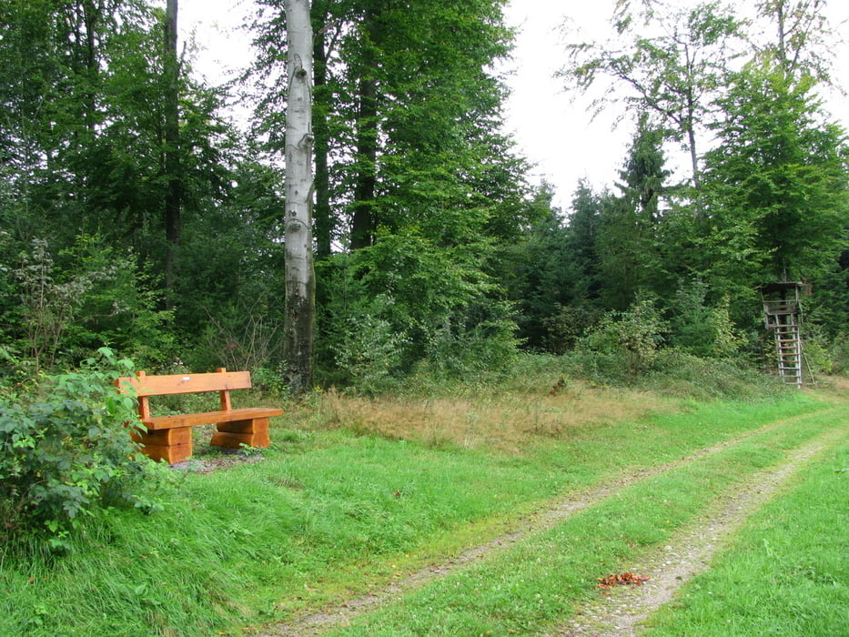
Anspruchsvolle Tour, vorbei an schönen Aussichtspunkten wie Bürstenstein und Palmfelsen. Knackige Anstiege und schöne Trails. Einkehrmöglichkeiten im Bergbauernhof "Fiese-Michel" oder in der Schloßschänke auf der Schauenburg.

- Start und Parkmöglichkeit Gasthaus Schwarzwaldtanne in Niederlehen
- Nicht unbedingt für MTB-Anfänger geeignet

galéria trás

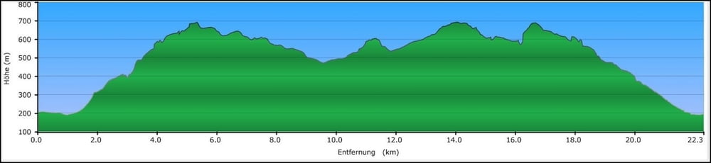
Mapa trasy a výškový profil

  • Open Street Map
  • Google
Minimum height 190 m Maximum height 693 m Detailný pohľad

More about the tour author

mb2002
Member since 2007

Send private message

komentáre

hyneck on 14.11.2011

tolle Landschaft, wenig Trail

viele schöne Aussichten, tolle Landschaft und Natur. Von den Trails hatte ich mir mehr versprochen, diese machen geschätzt nur 5% der Tour aus und sind ehr anspruchsvoll weil sie Berg aufwärts führen.

GPS trasy

Trackpoints
  • GPX / Garmin Map Source (gpx) download
  • TCX / Garmin Training Center® (tcx) download
  • CRS / Garmin Training Center® (crs) download
  • Google Earth (kml) download
  • G7ToWin (g7t) download
  • TTQV (trk) download
  • Overlay (ovl) download
  • Fugawi (txt) download
  • Kompass (DAV) Track (tk) download
  • list trasy (pdf) download
  • Original file of the author (gpx) download

More about the tour author

mb2002
Member since 2007

Send private message
Share track
Add to my favorites
Remove from my favorites
Edit tags
My score
Rate
trasa: Felsenrunde Oberkirch
Druh: horský bicykel
Dĺžka: 22,3 km
Evaluated on:
Doba:
Day(s)
Hour(s)
Minute(s)
ohodnotenie: Kraj pôžitok z túry kondícia technika