


Der letzte schöne Tag in 2011 lockt bei warmen 23°C um 10 Uhr morgens noch mal zu einer Extratour in den Kellerwald...
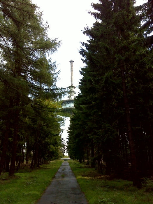
Von Cölbe führt die Strecke zunächst über den Radweg nach Schönstadt und dann auf Kreissträßchen über Bracht und Rosental weiter über Sehlen nach Haina. Bisher war die Tour schon schön, wird aber jetzt phänomenal auf der Straße (vorbei an ein paar Teichen) nach Battenhausen (wo es einen Skilift gibt - auch St. Anton des Kellerwalds genannt). Von Battenhausen konnten wir der Versuchung nicht widerstehen und sind noch auf das Hohe Lohr (zweithöchster Berg im Kellerwald) zum "Anschlagen" am Fernsehturm gefahren. Nun geht es überwiegend bergab nach Gemünden und dann über den Wohratal- und Ohmtalradweg wieder zurück nach Cölbe.
galéria trás
Mapa trasy a výškový profil
Minimum height 206 m
Maximum height 665 m
More about the tour author
|
|
thomi64 |
komentáre

GPS trasy
Trackpoints-
GPX / Garmin Map Source (gpx) download
-
TCX / Garmin Training Center® (tcx) download
-
CRS / Garmin Training Center® (crs) download
-
Google Earth (kml) download
-
G7ToWin (g7t) download
-
TTQV (trk) download
-
Overlay (ovl) download
-
Fugawi (txt) download
-
Kompass (DAV) Track (tk) download
-
list trasy (pdf) download
-
Original file of the author (gpx) download
More about the tour author
|
|
thomi64 |
Add to my favorites
Remove from my favorites
Edit tags
Open track
My score
Rate