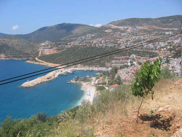
Die Gesamttour beginnt in Kas, geht über Kalkan in die Berge rein und endet auch wieder in Kas - und dann ergeben sich auch diese Länge und diese Höhenmeter. Man kann aber auch, und das empfehle ich, zunächst das Rad in Kas in den Dolmusch packen und die befahrene Küstenstraße sitzend in diesem Kleinbus zurücklegen. Dann rauf aufs Rad in die Berge rein und dort oben Richtung Kas fahren. Hoch über Kas biege ich nach Tour dann rechtwinklig rechts ab von der Hauptstraße. Das muß man nicht tun, denn das führt zurück nach Kalkan (und von dort wieder Küstenstraße zurück nach Kas, am besten wieder mit Dolmusch). Wenn ihr nach Kas zurück wollt, nicht abbiegen, sondern geradeaus und erst die nächste Asphaltstraße rechts abbiegen, dann kommt ihr direkt nach Kas - und dann sind das nur 45km und 1500hm.
galéria trás
Mapa trasy a výškový profil
Minimum height -9 m
Maximum height 1027 m
komentáre

Von Kas mit Dolmusch (Kleinbus) nach Kalkan und evtl. nach der Tour von dort auch wieder zurück mit Dolmusch.
Für diese Region gibt auch es ein Buch von Werner Eichhorn (www.bike-guide-tuerkei.eu): Bike Guide Türkische Riviera, 2007 Bergverlag Rother, ISBN 978-3-7633-5017-9
Für diese Region gibt auch es ein Buch von Werner Eichhorn (www.bike-guide-tuerkei.eu): Bike Guide Türkische Riviera, 2007 Bergverlag Rother, ISBN 978-3-7633-5017-9
GPS trasy
Trackpoints-
GPX / Garmin Map Source (gpx) download
-
TCX / Garmin Training Center® (tcx) download
-
CRS / Garmin Training Center® (crs) download
-
Google Earth (kml) download
-
G7ToWin (g7t) download
-
TTQV (trk) download
-
Overlay (ovl) download
-
Fugawi (txt) download
-
Kompass (DAV) Track (tk) download
-
list trasy (pdf) download
-
Original file of the author (gpx) download
Add to my favorites
Remove from my favorites
Edit tags
Open track
My score
Rate


