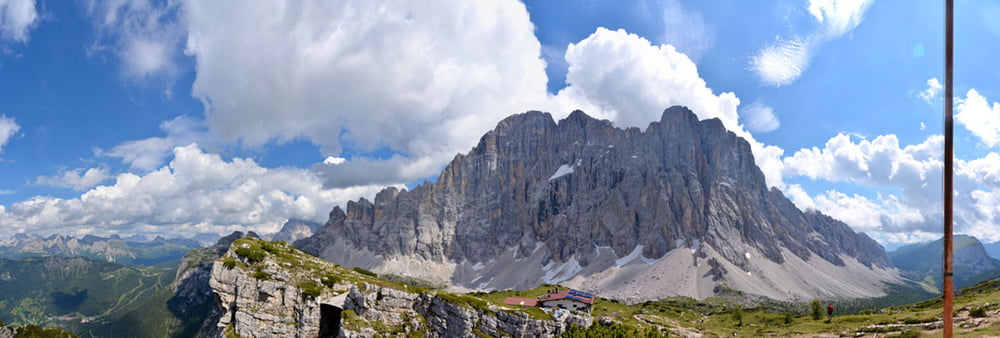
Eine faszinierende Bergtour im Civetta Massiv. Mit der Pezzè Seilbahn von Alleghe Richtung Rifugio Scoiattolo. Weg Nr. 564 führt uns zur Schutzhütte Cra di Pioda. Dort angekommen wechseln wir auf den Dolomitenhöhenweg Nr. 1 und gelangen so zum Lago di Coldai. Der Blick auf Alleghe, die Marmolata und die Türme des Civetta Massivs ist grandios. Weiter dem Dolomitenhöhenweg Nr. 1 Richtung Rifugio Tissi folgend genießen wir den Blick auf die Dolomitengipfel der Sella- und Langkofelgruppe, auf die Heiligkreuzkofelgruppe, den Lagazuoi, die Tofane, den Nuvolau und viele weitere. Von der Schutzhütte Tissi auf dem Col Rean aus steigen wir auf dem Steig mit der Nummer 563 über die Casamatta Alm zum Alleghe See ab.
Further information at
http://www.diewanderer.it/bergtour-civetta-alleghe-see/galéria trás
Mapa trasy a výškový profil
Minimum height 968 m
Maximum height 2279 m
komentáre

Von Bozen durch das Eggental nach Welschnofen am Karersee und weiter über den Karerpass ins Fasstal bis zum Pellegrino Pass. Von dort hinunter nach Alleghe zur Talstation der Pezzè Seilbahn, wo genügend Parkplätze vorhanden sind.
GPS trasy
Trackpoints-
GPX / Garmin Map Source (gpx) download
-
TCX / Garmin Training Center® (tcx) download
-
CRS / Garmin Training Center® (crs) download
-
Google Earth (kml) download
-
G7ToWin (g7t) download
-
TTQV (trk) download
-
Overlay (ovl) download
-
Fugawi (txt) download
-
Kompass (DAV) Track (tk) download
-
list trasy (pdf) download
-
Original file of the author (gpx) download
Add to my favorites
Remove from my favorites
Edit tags
Open track
My score
Rate


