Login

Zabudli ste prihlasovacia meno

Cookies have to be accepted!
Your browser's cookie functionality is disabled. Please enable this functionality.

Not a member yet?

Register now
Login

Available for registred users only

Log in to use this feature.

Zabudli ste prihlasovacia meno

Cookies have to be accepted!
Your browser's cookie functionality is disabled. Please enable this functionality.

Not a member yet?

Register now
Filter
Kategórie
Advanced filters
  • Dĺžka (km)
  • výškomer
Uložiť filter Reset filter

TrackRank

QRCode

Technical data

Dĺžka14,3 km výškomer786 m Way down1034 m Doba00:00 h:m dátum29.09.2011
ohodnotenia Author Kraj pôžitok z túry kondícia technika

štatistika

1320 náhľady ohodnotenia 58 Stiahnutia priemer
Rate
  • list trasy
  • príjazd
  • Stiahnutia
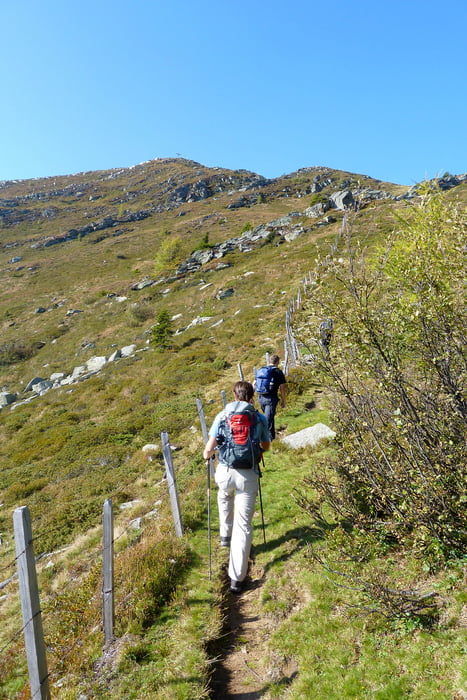
Von der Kohlweisshütte auf den Mirnock mit anschließendem Marsch Richtung Schwarzsee vorbei am Rindernock über Lahnernock und Palnock mit anschließendem Ziel der Schwarzseehütte, Abstieg Richtung Verditz

galéria trás

Mapa trasy a výškový profil

  • Open Street Map
  • Google
Minimum height 1272 m Maximum height 2108 m Detailný pohľad

More about the tour author

kateem
Member since 2010

Send private message

komentáre

GPS trasy

Trackpoints
  • GPX / Garmin Map Source (gpx) download
  • TCX / Garmin Training Center® (tcx) download
  • CRS / Garmin Training Center® (crs) download
  • Google Earth (kml) download
  • G7ToWin (g7t) download
  • TTQV (trk) download
  • Overlay (ovl) download
  • Fugawi (txt) download
  • Kompass (DAV) Track (tk) download
  • list trasy (pdf) download
  • Original file of the author (gpx) download

More about the tour author

kateem
Member since 2010

Send private message
Share track
Add to my favorites
Remove from my favorites
Edit tags
My score
Rate
trasa: Mirnock - Schwarzseehütte
Druh: trasa
Dĺžka: 14,3 km
Evaluated on:
Doba:
Day(s)
Hour(s)
Minute(s)
ohodnotenie: Kraj pôžitok z túry kondícia technika