Login

Zabudli ste prihlasovacia meno

Cookies have to be accepted!
Your browser's cookie functionality is disabled. Please enable this functionality.

Not a member yet?

Register now
Login

Available for registred users only

Log in to use this feature.

Zabudli ste prihlasovacia meno

Cookies have to be accepted!
Your browser's cookie functionality is disabled. Please enable this functionality.

Not a member yet?

Register now
Filter
Kategórie
Advanced filters
  • Dĺžka (km)
  • výškomer
Uložiť filter Reset filter

TrackRank

QRCode

Technical data

Dĺžka34,3 km výškomer512 m Way down2160 m Doba00:00 h:m dátum02.10.2011
ohodnotenia Author Kraj pôžitok z túry kondícia technika

štatistika

1963 náhľady ohodnotenia 389 Stiahnutia priemer
Rate
  • list trasy
  • príjazd
  • Stiahnutia

 Eine der zahllosen Varianten um den Monte Baldo herunterzufahren. Großteiles über Schotter- und Asphaltwegen gut fahrbar. Teilweise aber auch stark verblockt, und für uns war schieben angesagt.
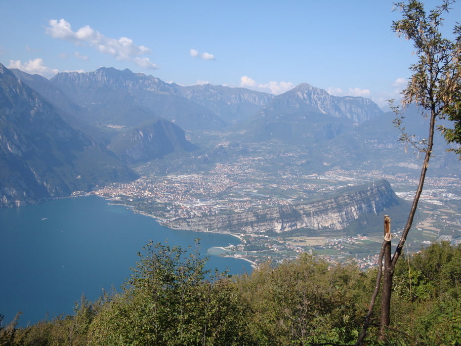
Wer schon mal auf dem Monte Baldo war weiß das es eines der Highlights am Gardasee ist, wenn es um Landschaft und Spaß Faktor geht.


galéria trás

Mapa trasy a výškový profil

  • Open Street Map
  • Google
Minimum height 96 m Maximum height 1751 m Detailný pohľad

More about the tour author

juergenedler
Member since 2008

Send private message

komentáre

Talstadion der Seilbahn auf den Monte Baldo in Malcesine

GPS trasy

Trackpoints
  • GPX / Garmin Map Source (gpx) download
  • TCX / Garmin Training Center® (tcx) download
  • CRS / Garmin Training Center® (crs) download
  • Google Earth (kml) download
  • G7ToWin (g7t) download
  • TTQV (trk) download
  • Overlay (ovl) download
  • Fugawi (txt) download
  • Kompass (DAV) Track (tk) download
  • list trasy (pdf) download
  • Original file of the author (gpx) download

More about the tour author

juergenedler
Member since 2008

Send private message
Share track
Add to my favorites
Remove from my favorites
Edit tags
My score
Rate
trasa: Monte Baldo - Torbole
Druh: horský bicykel
Dĺžka: 34,3 km
Evaluated on:
Doba:
Day(s)
Hour(s)
Minute(s)
ohodnotenie: Kraj pôžitok z túry kondícia technika