Login

Zabudli ste prihlasovacia meno

Cookies have to be accepted!
Your browser's cookie functionality is disabled. Please enable this functionality.

Not a member yet?

Register now
Login

Available for registred users only

Log in to use this feature.

Zabudli ste prihlasovacia meno

Cookies have to be accepted!
Your browser's cookie functionality is disabled. Please enable this functionality.

Not a member yet?

Register now
Filter
Kategórie
Advanced filters
  • Dĺžka (km)
  • výškomer
Uložiť filter Reset filter

TrackRank

QRCode

Technical data

Dĺžka6,0 km výškomer234 m Way down189 m Doba00:00 h:m dátum15.11.2011
ohodnotenia Author Kraj pôžitok z túry kondícia technika

štatistika

906 náhľady ohodnotenia 20 Stiahnutia priemer
Rate
  • list trasy
  • príjazd
  • Stiahnutia

Dieser Rundweg beginnt im Stadtteil Winkels von Bad Kissingen am Sportplatz.
Wir gehen die RTreppenstufen hinauf und folgen einen kleinen Pfad zum Sinnberg.

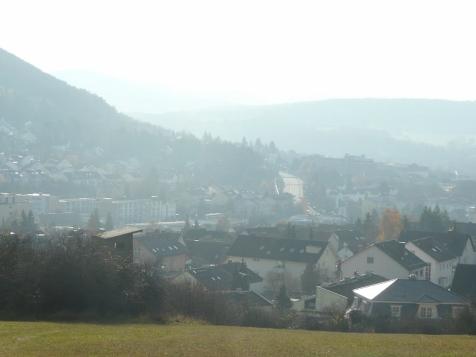
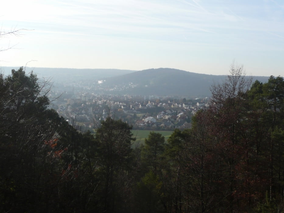
Hier hat man eine sehr schöne Aussicht nach Bad Kissingen . Hier folgen wir den Weg zum Waldschlösschen und von hier aus bis zur Schutzhütte.

Hier zweigt der Weg wieder Richtung Winkels ab.

galéria trás

Mapa trasy a výškový profil

  • Open Street Map
  • Google
Minimum height 202 m Maximum height 371 m Detailný pohľad

More about the tour author

maffy
Member since 2006

Send private message

komentáre

Münnerstädter Straße Richtung Nüdlingen dann beim Tüv  links zum Sportplatz in Winkels

GPS trasy

Trackpoints
  • GPX / Garmin Map Source (gpx) download
  • TCX / Garmin Training Center® (tcx) download
  • CRS / Garmin Training Center® (crs) download
  • Google Earth (kml) download
  • G7ToWin (g7t) download
  • TTQV (trk) download
  • Overlay (ovl) download
  • Fugawi (txt) download
  • Kompass (DAV) Track (tk) download
  • list trasy (pdf) download
  • Original file of the author (gpx) download

More about the tour author

maffy
Member since 2006

Send private message
Share track
Add to my favorites
Remove from my favorites
Edit tags
My score
Rate
trasa: Bad Kissingen - Sinnberg - Osterberg - Winkels
Druh: trasa
Dĺžka: 6,0 km
Evaluated on:
Doba:
Day(s)
Hour(s)
Minute(s)
ohodnotenie: Kraj pôžitok z túry kondícia technika