Login

Zabudli ste prihlasovacia meno

Cookies have to be accepted!
Your browser's cookie functionality is disabled. Please enable this functionality.

Not a member yet?

Register now
Login

Available for registred users only

Log in to use this feature.

Zabudli ste prihlasovacia meno

Cookies have to be accepted!
Your browser's cookie functionality is disabled. Please enable this functionality.

Not a member yet?

Register now
Filter
Kategórie
Advanced filters
  • Dĺžka (km)
  • výškomer
Uložiť filter Reset filter

TrackRank

QRCode

Technical data

Dĺžka9,2 km výškomer64 m Way down68 m Doba01:30 h:m dátum21.11.2011
ohodnotenia Author Kraj pôžitok z túry kondícia technika

štatistika

915 náhľady ohodnotenia 62 Stiahnutia priemer
Rate
  • list trasy
  • príjazd
  • Stiahnutia

Netterundweg


galéria trás

Mapa trasy a výškový profil

  • Open Street Map
  • Google
Minimum height 37 m Maximum height 84 m Detailný pohľad

More about the tour author

waguenter
Member since 2011

Send private message

komentáre

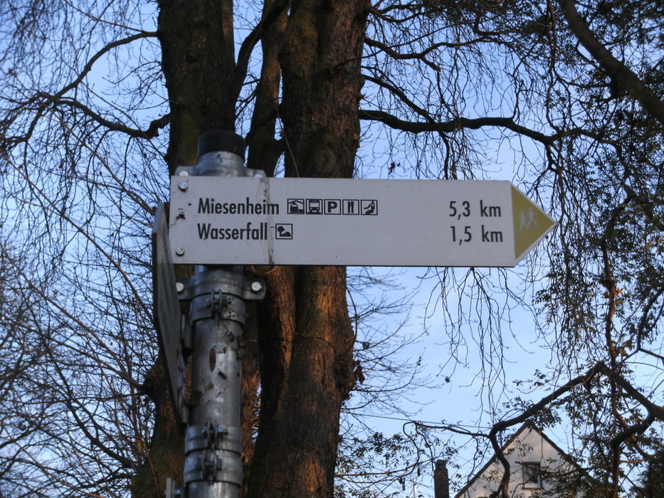
Andernach/Miesenheim

Parken auf dem Dorfplatz Miesenheim

Richtung Andernach gehen

immer dem Schild mit dem blauen " N" auf weißem Hintergrund folgen.


GPS trasy

Trackpoints
  • GPX / Garmin Map Source (gpx) download
  • TCX / Garmin Training Center® (tcx) download
  • CRS / Garmin Training Center® (crs) download
  • Google Earth (kml) download
  • G7ToWin (g7t) download
  • TTQV (trk) download
  • Overlay (ovl) download
  • Fugawi (txt) download
  • Kompass (DAV) Track (tk) download
  • list trasy (pdf) download
  • Original file of the author (gpx) download

More about the tour author

waguenter
Member since 2011

Send private message
Share track
Add to my favorites
Remove from my favorites
Edit tags
My score
Rate
trasa: Netterundweg
Druh: trasa
Dĺžka: 9,2 km
Evaluated on:
Doba:
Day(s)
Hour(s)
Minute(s)
ohodnotenie: Kraj pôžitok z túry kondícia technika