
")

Kleine Forcola Runde
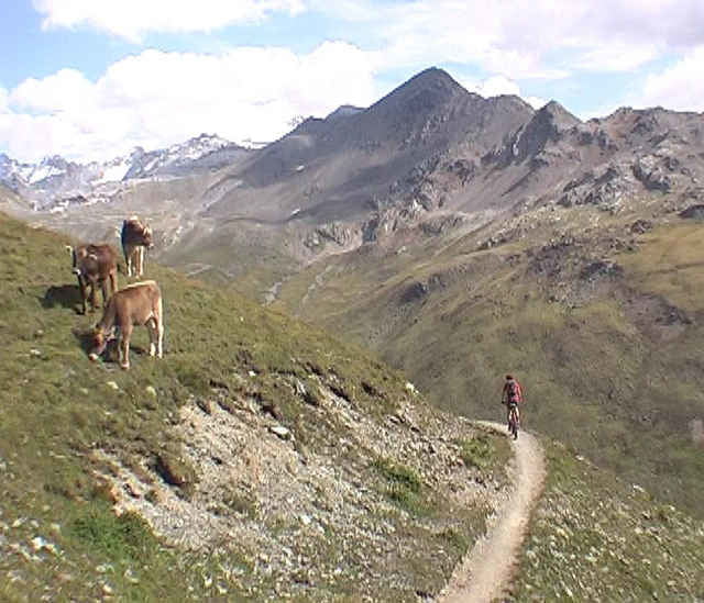
Diese kleine Forcola Runde führt durch eine landschaftlich großartige Bergwelt im Grenzgebiet Italien - Schweiz und ist ein Muss für alle Trailliebhaber.
Aber Vorsicht!!!! Alpine Bikerfahrung ist auf dieser fahrtechnisch sehr schweren Tour unbedingt von Nöten der Downhill ist ein echtes Abenteuer man sollte schwindelfrei sein und sein Bike super beherrschen, sonst läuft man ca 400hm down.
Diese kleine Tour beginnt am Pass Umbrail, führt dann auf einem 4Km langen Trail entlang an einem Bergrücken zur Bocchetta di Forcolla (2768) nun geht es zur Bocchetta de Pedenollo .
Hier beginnt der Wahnsinns Downhill der im unteren Teil mit extrem viel Vorsicht zu fahren ist. Der nun folgende Uphill durch das Valle Forcola ist ab der Baita de Forcola richtig harte Arbeit ohne Top Kondition und Fahrtechnik wird man wohl 500 hm schieben. (Echte Könner werden fast alles fahren) Die Tour ist kurz und echt hart , für Top Biker fast vollständig fahrbar, der weniger erfahrene Biker wird viel laufen.
Tour wurde uns vom super Bikeguide „Helge“ vom Reiterhof in Nauders (Klasse Bike-Pension ***** vwww.reiterhof-nauders.com) ausgearbeitet und empfohlen.
Further information at
http://www.reiterhof-nauders.comgaléria trás
Mapa trasy a výškový profil
Minimum height 2076 m
Maximum height 2776 m
More about the tour author

|
gpsbiker |
komentáre

GPS trasy
Trackpoints-
GPX / Garmin Map Source (gpx) download
-
TCX / Garmin Training Center® (tcx) download
-
CRS / Garmin Training Center® (crs) download
-
Google Earth (kml) download
-
G7ToWin (g7t) download
-
TTQV (trk) download
-
Overlay (ovl) download
-
Fugawi (txt) download
-
Kompass (DAV) Track (tk) download
-
list trasy (pdf) download
-
Original file of the author (gpx) download
More about the tour author
|
|
gpsbiker |
Add to my favorites
Remove from my favorites
Edit tags
Open track
My score
Rate