


Die Haustour der Melibokus Biker.
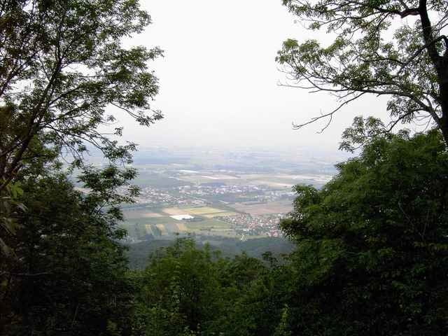
Die Tour führt zunächst zu der Burgruine Tannenberg. Von hier aus hat man einen schönen Ausblick auf Seeheim und das Ziel, den Melibokus. Zwischen Melibokus und dem Tannenberg liegen zwei Täler ( Stettbacher und Balkäuser Tal ). Wir umgehen die Täler und fahren zum Steigerts und von da, zum Melibokus.
Es werden nur gut ausgebaute Feld und Waldwege befahren. Dadurch ist die Tour technisch nicht anspruchsvoll.
Die Strecke:
Jugenheim, Tannenberg, Steigerts, Kuralpe, Brücke Balkausen, Melibokus u. Jugenheim
Die Tour wird auch von den http://www.sporttogether.de angeboten.
Further information at
http://www.sporttogether.degaléria trás
Mapa trasy a výškový profil
Minimum height 126 m
Maximum height 518 m
More about the tour author

|
Karl |
komentáre

A5, Ausfahrt Seeheim-Jugenheim, Richtung Seeheim-Jugenheim immer geradeaus. Man kommt direkt nach Seeheim-Jugenheim Ortsteil Jugenheim. Über die Straßenbahnschienen, dann noch ca. 150m
Treffpunkt ist das Bistro Villa Journal.
Treffpunkt ist das Bistro Villa Journal.
GPS trasy
Trackpoints-
GPX / Garmin Map Source (gpx) download
-
TCX / Garmin Training Center® (tcx) download
-
CRS / Garmin Training Center® (crs) download
-
Google Earth (kml) download
-
G7ToWin (g7t) download
-
TTQV (trk) download
-
Overlay (ovl) download
-
Fugawi (txt) download
-
Kompass (DAV) Track (tk) download
-
list trasy (pdf) download
-
Original file of the author (g7t) download
More about the tour author
|
|
Karl |
Add to my favorites
Remove from my favorites
Edit tags
Open track
My score
Rate