
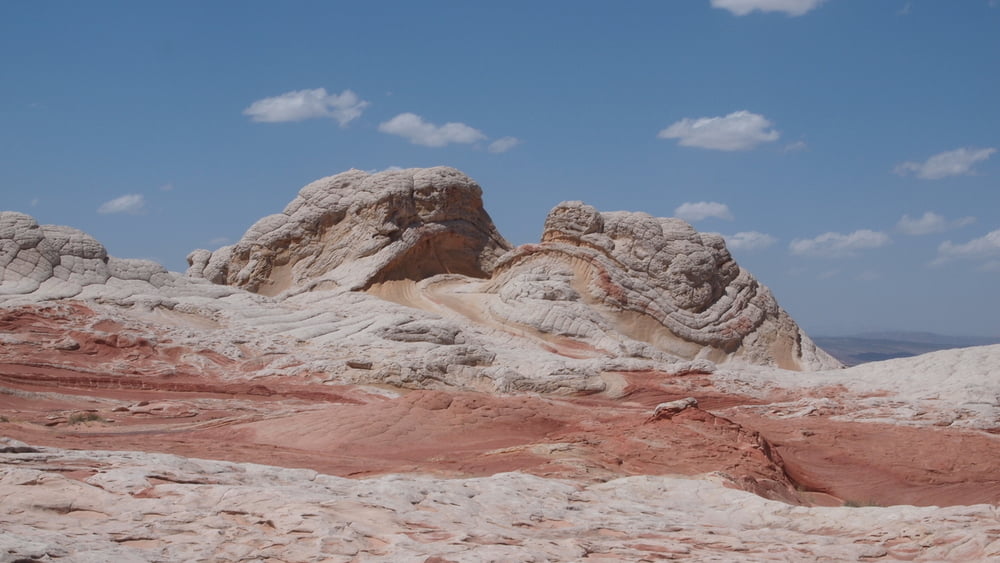

The area of White Pocket on the Paria Plateau in Northern Arizona is very impressive.
The "White Pocket" area to the east is seldom visited, probably because of its remoteness and/or the requirement of 4WD to access the area.
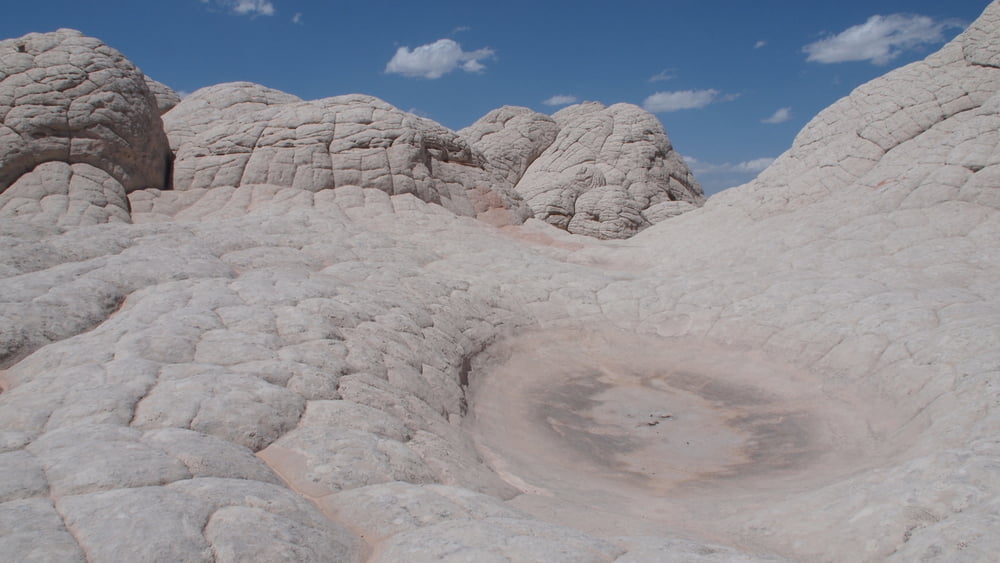
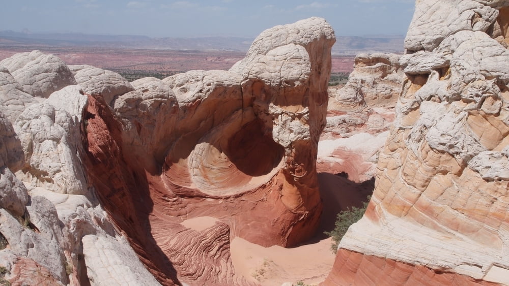
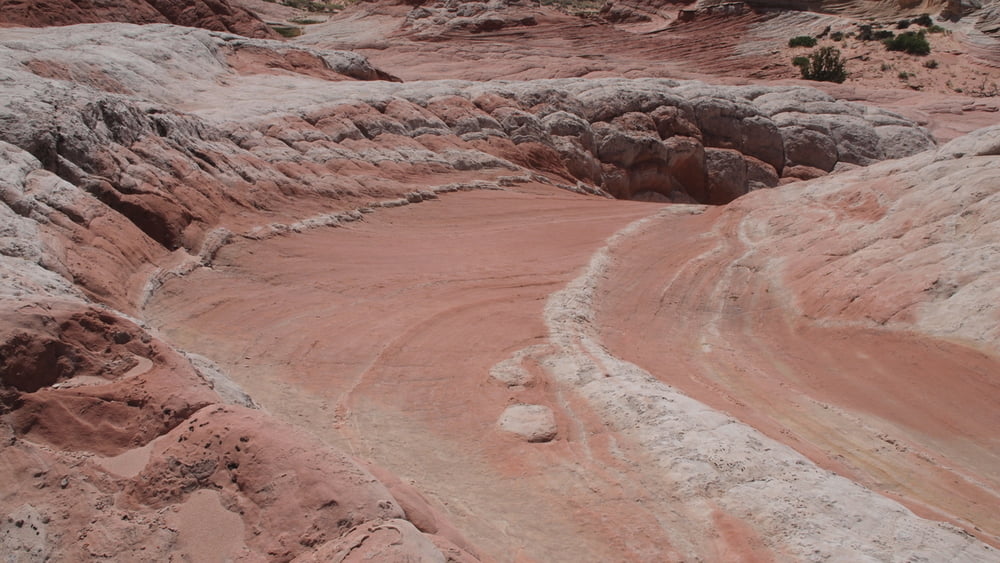
The impressive White Pocket will fill the senses beyond imagination!
The drive to the swirling, twisted, multicolored natural artwork is an adventure in its own right, the exploration by foot is endless.
We spended just a couple of hours, "White Pocket" will surely become "top of the top" in the list of special places.
There is no formal trail,just wandering and exploring.
This area has colors, shapes and textures that are hard to beat, but remember that it is an extremely fragile environment.
Whenever you consider a guided day or multi-day tour Think of Dreamland Safari Tours located in Kanab.One of the best. Website : http://www.dreamlandtours.net/
The "White Pocket" area to the east is seldom visited, probably because of its remoteness and/or the requirement of 4WD to access the area.
The impressive White Pocket will fill the senses beyond imagination!
The drive to the swirling, twisted, multicolored natural artwork is an adventure in its own right, the exploration by foot is endless.
We spended just a couple of hours, "White Pocket" will surely become "top of the top" in the list of special places.
There is no formal trail,just wandering and exploring.
This area has colors, shapes and textures that are hard to beat, but remember that it is an extremely fragile environment.
Whenever you consider a guided day or multi-day tour Think of Dreamland Safari Tours located in Kanab.One of the best. Website : http://www.dreamlandtours.net/
Galería de rutas


Mapa de la ruta y perfil de altitud
Minimum height 1700 m
Maximum height 1812 m
More about the tour author

|
willydn |
Comentarios

From Kanab, drive 40 miles east on Highway 89.The turn onto House Rock Road is located on the south side of the road. It is located between mile markers 25 and 26.
Drive 20.7 miles on House Rock Road, turn left on BLM1017(Pine Tree Road)
Road access by BLM1017 - BLM1066 - BLM1081 - BLM1082 into Coyote Buttes South.
The route to Cottonwood Cove is about twelve miles from House Rock Valley Road and takes a little under an hour.After the first easy road segment BLM-1017, things get a little bit more difficult.The remaining segments are definitely four-wheel drive and high-clearance.A couple of mile before reaching Cottonwood Cove, we pass through Poverty Flat.(ruins of an old ranch)
Just north of the buildings there is an old windmill.From the parking area at Cottonwood Cove, we went to the White Pocket. From Coyote Buttes South, we drove back to Poverty flat turned left.
We followed our prepared gps track to finally reach the White Pocket area.
Tracks GPS
Puntos del track-
GPX / Garmin Map Source (gpx) download
-
TCX / Garmin Training Center® (tcx) download
-
CRS / Garmin Training Center® (crs) download
-
Google Earth (kml) download
-
G7ToWin (g7t) download
-
TTQV (trk) download
-
Overlay (ovl) download
-
Fugawi (txt) download
-
Kompass (DAV) Track (tk) download
-
Hoja de ruta (pdf) download
-
Original file of the author (gpx) download
More about the tour author
|
|
willydn |
Añadir a mis favoritos
Eliminar de mis favoritos
Edit tags
Open track
Mi valoración
Rate