Login

¿Ha olvidado su contraseña?

Las cookies tienen que estar habilitadas!
Las cookies no están habilitadas en tu navegador. Por favor, modifica la configuración antes de continuar.

Not a member yet?

Register now
Login

Available for registred users only

Log in to use this feature.

¿Ha olvidado su contraseña?

Las cookies tienen que estar habilitadas!
Las cookies no están habilitadas en tu navegador. Por favor, modifica la configuración antes de continuar.

Not a member yet?

Register now
Filtro
Categorías
Filtros avanzados
  • Distancia (km)
  • Altitud en metros
Guardar filtro Restablecer filtro

TrackRank

QRCode

Technical data

Distancia13,9 km Altitud en metros733 m Descenso756 m Duración00:00 h:m Fecha11.05.2016
Valoraciones Autor Paisaje Diversión Condición Técnica

Estadística

234 Visitas Valoraciones 22 Descargas Promedio
Rate
  • Hoja de ruta
  • Punto de partida
  • Descargas

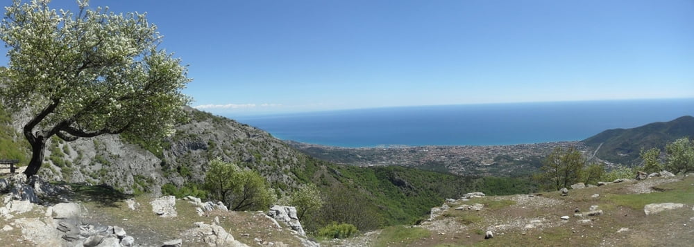
Wandertour über das alte Kloster San Pietro und Mt. Ravient zum Mt. Carmo.

Schöne Wandertour mit Aussicht, schön zu jeder Jahreszeit.
 

Einzig schwierig war die fehlende Markierung vom Mt. Ravient hinunter zum Querweg Richtung Mt. Carmo. Wir haben eine Weile gesucht und sind dann am Gipfel etwas rechts vom Gipfel (Richtung Finale schauend) hinunter. Der in OSM eingezeichnete Weg ist nicht zu finden. Hier auf jeden Fall den GPS-Track anschauen. Der Weg lt. OSM ist in Wegpunkten markiert, es geht um eine Höhendiifferenz von ca. 50m bis unten der Weg quer kommt.


Galería de rutas

Mapa de la ruta y perfil de altitud

  • Open Street Map
  • Google
Minimum height 769 m Maximum height 1395 m Vista detallada

More about the tour author

skyhopper
Miembro desde 2005

Enviar mensaje privado

Comentarios

parken am Pass GIOGO DI TOIRANO (Strecke Loano-Toirano-GIOGO DI TOIRANO-Bardineto-Callizzano.


Tracks GPS

Puntos del track
  • GPX / Garmin Map Source (gpx) download
  • TCX / Garmin Training Center® (tcx) download
  • CRS / Garmin Training Center® (crs) download
  • Google Earth (kml) download
  • G7ToWin (g7t) download
  • TTQV (trk) download
  • Overlay (ovl) download
  • Fugawi (txt) download
  • Kompass (DAV) Track (tk) download
  • Hoja de ruta (pdf) download
  • Original file of the author (gpx) download

More about the tour author

skyhopper
Miembro desde 2005

Enviar mensaje privado
Share track
Añadir a mis favoritos
Eliminar de mis favoritos
Edit tags
Mi valoración
Rate
Ruta: San Pietro - Mt. Ravient - Mt. Carmo
Tipo: Excursionismo
Distancia: 13,9 km
valorizado al:
Duración:
Day(s)
Hour(s)
Minute(s)
Valoración: Paisaje Diversión Condición Técnica