Login

Olvidaste tu contraseña?

Las cookies tienen que estar habilitadas!
Las cookies no están habilitadas en tu navegador. Por favor, modifica la configuración antes de continuar.

Not a member yet?

Register now
Login

Available for registred users only

Log in to use this feature.

Olvidaste tu contraseña?

Las cookies tienen que estar habilitadas!
Las cookies no están habilitadas en tu navegador. Por favor, modifica la configuración antes de continuar.

Not a member yet?

Register now
Filtro
Categorías
Advanced filters
  • Distancia (km)
  • Altitud en metros
Guardar filtro Reset filter

TrackRank

QRCode

Technical data

Distancia7,6 km Altitud en metros549 m Descenso500 m Duración03:00 h:m Fecha03.06.2017
Valoraciones Autor Paisaje Diversión Condición Técnica

Estadística

95 Visitas Valoraciones 9 Descargas Promedio
Rate
  • Hoja de ruta
  • Punto de partida
  • Descargas
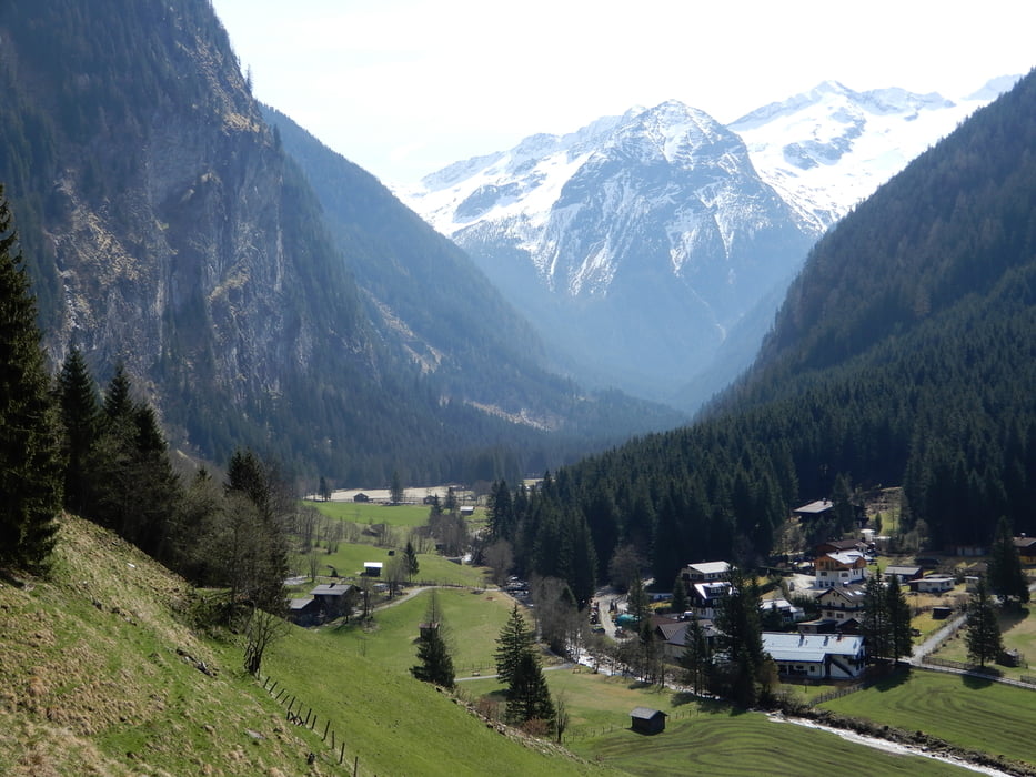
short trip to Poserhöhe, a mountain cabin with beverages and meals. begins at Kötschachtal steep up, nice view to valley and Stubnerkogel, the ski mountain here, to Poserhöhe, down a road, no traffic, just for the farmers here. both ways possible. This is counterclockwise, if you want go up less steep, go clockwise. Can combinded with other tours I upload here. Just look for more and download all, see on basecamp and your GPS. 

Galería de rutas

Mapa de la ruta y perfil de altitud

  • Open Street Map
  • Google
Minimum height 913 m Maximum height 1486 m Vista detallada

More about the tour author

oldienotgoldie
Member since 2017

Send private message

Comentarios

Tracks GPS

Puntos del track
  • GPX / Garmin Map Source (gpx) download
  • TCX / Garmin Training Center® (tcx) download
  • CRS / Garmin Training Center® (crs) download
  • Google Earth (kml) download
  • G7ToWin (g7t) download
  • TTQV (trk) download
  • Overlay (ovl) download
  • Fugawi (txt) download
  • Kompass (DAV) Track (tk) download
  • Hoja de ruta (pdf) download
  • Original file of the author (gpx) download

More about the tour author

oldienotgoldie
Member since 2017

Send private message
Share track
Add to my favorites
Remove from my favorites
Edit tags
Mi valoración
Rate
Ruta: Poserhöhe, round trip
Tipo: Excursionismo
Distancia: 7,6 km
valorizado al:
Duración:
Day(s)
Hour(s)
Minute(s)
Valoración: Paisaje Diversión Condición Técnica