
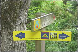

Also check my tour links und rechts von Pappelteich. It has more distance more climbs and more funs (beware that most trails are Wanderwege and you are an 'illegal biker" like me....
Mapa de la ruta y perfil de altitud
Minimum height 271 m
Maximum height 453 m
More about the tour author

|
zwartr |
Comentarios

Parkplatz Wittgensteinstrasse, 13. Bezirk Wien
Tracks GPS
Puntos del track-
GPX / Garmin Map Source (gpx) download
-
TCX / Garmin Training Center® (tcx) download
-
CRS / Garmin Training Center® (crs) download
-
Google Earth (kml) download
-
G7ToWin (g7t) download
-
TTQV (trk) download
-
Overlay (ovl) download
-
Fugawi (txt) download
-
Kompass (DAV) Track (tk) download
-
Hoja de ruta (pdf) download
-
Original file of the author (gpx) download
More about the tour author
|
|
zwartr |
Añadir a mis favoritos
Eliminar de mis favoritos
Edit tags
Open track
Mi valoración
Rate