Login

¿Ha olvidado su contraseña?

Las cookies tienen que estar habilitadas!
Las cookies no están habilitadas en tu navegador. Por favor, modifica la configuración antes de continuar.

Not a member yet?

Register now
Login

Available for registred users only

Log in to use this feature.

¿Ha olvidado su contraseña?

Las cookies tienen que estar habilitadas!
Las cookies no están habilitadas en tu navegador. Por favor, modifica la configuración antes de continuar.

Not a member yet?

Register now
Filtro
Categorías
Filtros avanzados
  • Distancia (km)
  • Altitud en metros
Guardar filtro Restablecer filtro

TrackRank

QRCode

Technical data

Distancia27,9 km Altitud en metros1469 m Descenso1745 m Duración07:00 h:m Fecha01.11.2005
Valoraciones Autor User Paisaje Diversión Condición Técnica

Estadística

5272 Visitas 5 Valoraciones 584 Descargas 4.60 Promedio
Rate
  • Hoja de ruta
  • Punto de partida
  • Descargas

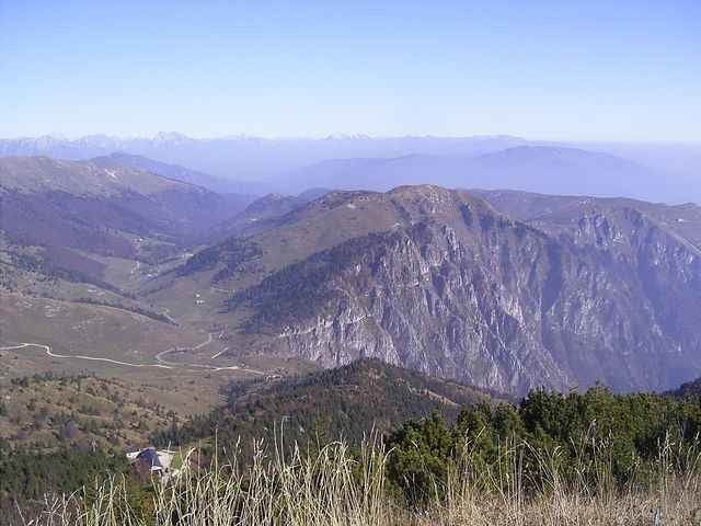
Tour on old donkey way from Bassano del Grappa - Crespano - Modonna del Cavallo to the Mt. Grappa monument (1st world war). 


 The way down is going along a trail along the mountain top with some small walking passages, than on a spectacular trail cut into the mountain with spectacular view!. The way down to San Liberale is the sentiero 153 (S1-S2 level), a good biker can drive nearly everything, but be carefull in driving, the way is most of the time small and cut into the mountain.

  If you find the sentiero 153 to difficult, in about 3km is a easy way down to  San Liberale S0
 

August 2012 - track erneurert - Auffahrt nun komplett fahrbar

Galería de rutas

Mapa de la ruta y perfil de altitud

  • Open Street Map
  • Google
Minimum height 287 m Maximum height 1734 m Vista detallada

More about the tour author

skyhopper
Miembro desde 2005

Enviar mensaje privado

Comentarios

Checco al 21.12.2006

Error on the description

The sentiero of the way down in the track is not the CAI 151. I have do it, with my gps and the track of this tour does not corrisponding with my track (i have a photo of the real sentiero 151 too): http://81.208.98.134/FotoMountainBike/2006-12-17%20Grappa-cai%20151%20800x600/index.htm
I think that the sentiero in the track of this tour is the CAI 150. Next time that i going in the Monte Grappa, i'll do it.
Checco al 27.12.2006

Finally, I just do it. You have do the sentiero CAI 153 and i have found it VERY nice ! It's very spectacular. Thank you for this. I have same photo of it:
http://172.16.1.2/FotoMountainBike/2006-12-23%20Grappa%20Cai153%20800x600/index.htm
Trento on SS47 until exit Bssano, left to Romano Ezellino and Crespano. In Crespano on the traffic light left to Madonno di Cavallo church.

Tracks GPS

Puntos del track
  • GPX / Garmin Map Source (gpx) download
  • TCX / Garmin Training Center® (tcx) download
  • CRS / Garmin Training Center® (crs) download
  • Google Earth (kml) download
  • G7ToWin (g7t) download
  • TTQV (trk) download
  • Overlay (ovl) download
  • Fugawi (txt) download
  • Kompass (DAV) Track (tk) download
  • Hoja de ruta (pdf) download
  • Original file of the author (gpx) download

More about the tour author

skyhopper
Miembro desde 2005

Enviar mensaje privado
Share track
Añadir a mis favoritos
Eliminar de mis favoritos
Edit tags
Mi valoración
Rate
Ruta: Veneto: Bassano del Grappa - Crespano - Mt Grappa 1760m sentiero 153
Tipo: Bicicletas de montaña
Distancia: 27,9 km
valorizado al:
Duración:
Day(s)
Hour(s)
Minute(s)
Valoración: Paisaje Diversión Condición Técnica