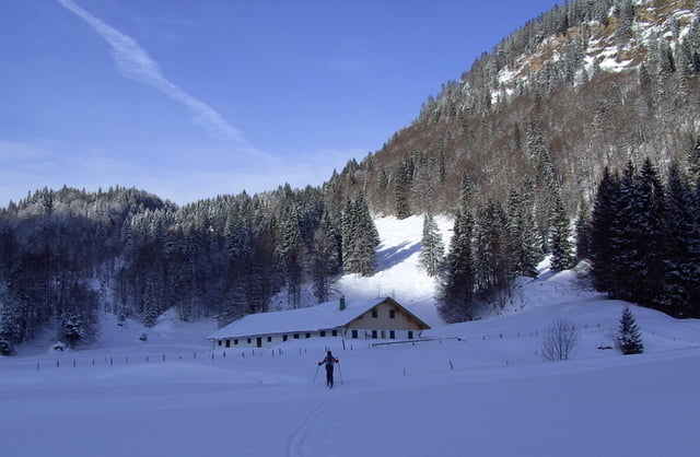
Skitour mit Skateinlage.
Vom Parkplatz Gunzesrieder Säge auf der Gunzesrieder Loipe bis zur hinteren Aualpe etwa 4,5 km.
Hier beginnt der eigentliche Aufstieg auf Forstweg durch eine schöne breite Waldschneise, dann über freie Hänge zur Güntlesscharte und weiter dem Grat entlang zum Güntleskopf.
Galería de rutas
Mapa de la ruta y perfil de altitud
Minimum height 953 m
Maximum height 1730 m
Comentarios

Kempten Allgäu über Immenstadt, Blaichach Gunzesried, Parkplatz (€ 3,--) beim kleinen Lift links am Beginn der Mautstraße.
Tracks GPS
Puntos del track-
GPX / Garmin Map Source (gpx) download
-
TCX / Garmin Training Center® (tcx) download
-
CRS / Garmin Training Center® (crs) download
-
Google Earth (kml) download
-
G7ToWin (g7t) download
-
TTQV (trk) download
-
Overlay (ovl) download
-
Fugawi (txt) download
-
Kompass (DAV) Track (tk) download
-
Hoja de ruta (pdf) download
-
Original file of the author (gpx) download
Añadir a mis favoritos
Eliminar de mis favoritos
Edit tags
Open track
Mi valoración
Rate


