Login

¿Ha olvidado su contraseña?

Las cookies tienen que estar habilitadas!
Las cookies no están habilitadas en tu navegador. Por favor, modifica la configuración antes de continuar.

Not a member yet?

Register now
Login

Available for registred users only

Log in to use this feature.

¿Ha olvidado su contraseña?

Las cookies tienen que estar habilitadas!
Las cookies no están habilitadas en tu navegador. Por favor, modifica la configuración antes de continuar.

Not a member yet?

Register now
Filtro
Categorías
Filtros avanzados
  • Distancia (km)
  • Altitud en metros
Guardar filtro Restablecer filtro

TrackRank

QRCode

Technical data

Distancia47,2 km Altitud en metros895 m Descenso892 m Duración03:15 h:m Fecha13.04.2009
Valoraciones Autor User Paisaje Diversión Condición Técnica

Estadística

386 Visitas 1 Valoración 113 Descargas 5.00 Promedio
Rate
  • Hoja de ruta
  • Punto de partida
  • Descargas

Startpunkt ist in Olpe am Kimiker Berg, altern. für Auswärtige auch ab dem Hallenbad mit guten Parkmöglichkeiten.

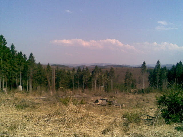
Die Tour führt mit ein paar schönen Singletrailabschnitten über Thieringhausen zur Krombacher Höhe und weiter nach Fahlenscheid. Es bieten sich zahlreiche schöne Ausblicke über das Land der tausend Berge.

Weiter geht es nach Querung des Napoleonweges in Richtung Waldenburg. Dort wartet eine fahrtechnische Herausforderung von der Ruine hinunter zum Biggeufer. Danach radelt man gemütlich an der Bigge entlang zurück zum Hallenbad nach Olpe, nicht ohne noch den kleinen Schlenker mit einer super Trail Abfahrt mitgenommen zu haben. 

Mapa de la ruta y perfil de altitud

  • Open Street Map
  • Google
Minimum height 312 m Maximum height 563 m Vista detallada

More about the tour author

chrischulte
Miembro desde 2009

Enviar mensaje privado

Comentarios

Tracks GPS

Puntos del track
  • GPX / Garmin Map Source (gpx) download
  • TCX / Garmin Training Center® (tcx) download
  • CRS / Garmin Training Center® (crs) download
  • Google Earth (kml) download
  • G7ToWin (g7t) download
  • TTQV (trk) download
  • Overlay (ovl) download
  • Fugawi (txt) download
  • Kompass (DAV) Track (tk) download
  • Hoja de ruta (pdf) download
  • Original file of the author (gpx) download

More about the tour author

chrischulte
Miembro desde 2009

Enviar mensaje privado
Share track
Añadir a mis favoritos
Eliminar de mis favoritos
Edit tags
Mi valoración
Rate
Ruta: Östliche Biggetour
Tipo: Bicicletas de montaña
Distancia: 47,2 km
valorizado al:
Duración:
Day(s)
Hour(s)
Minute(s)
Valoración: Paisaje Diversión Condición Técnica