Login

¿Ha olvidado su contraseña?

Las cookies tienen que estar habilitadas!
Las cookies no están habilitadas en tu navegador. Por favor, modifica la configuración antes de continuar.

Not a member yet?

Register now
Login

Available for registred users only

Log in to use this feature.

¿Ha olvidado su contraseña?

Las cookies tienen que estar habilitadas!
Las cookies no están habilitadas en tu navegador. Por favor, modifica la configuración antes de continuar.

Not a member yet?

Register now
Filtro
Categorías
Filtros avanzados
  • Distancia (km)
  • Altitud en metros
Guardar filtro Restablecer filtro

TrackRank

QRCode

Technical data

Distancia163,1 km Altitud en metros6308 m Descenso5939 m Duración5 días 10 h Fecha06.09.2009
Valoraciones Autor Paisaje Diversión Condición Técnica

Estadística

1257 Visitas Valoraciones 173 Descargas Promedio
Rate
  • Hoja de ruta
  • Punto de partida
  • Descargas

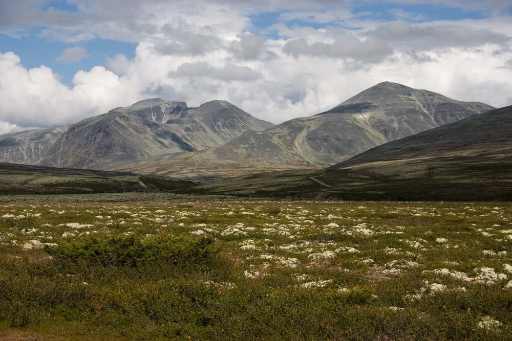
During second week in Norway we visited two national parks: NP Rondane and NP Dovre.

We have approximately half of time good partly cloudy weather withtemperatures between 15-20 degrees during day and little bit lower inthe night. Second half of our time weather was rather cloudy with rainwith temperatures little bit above freeze level.

There are many lakes, streams and rivers in these areas, so it is no needed to carry much water.

A lot of reindeers are living around here and if you have fortune you will see some different species of wild animals.

You can camping there in a tent without any problems. By Norway's laws you are permitted to set up a tent everywhere in the country further than 150 meters from dwelling.

Más información en

http://www.ms.mff.cuni.cz/~jhum8111/hory/norsko_2009/norsko_2009.html

Galería de rutas

Mapa de la ruta y perfil de altitud

  • Open Street Map
  • Google
Minimum height 280 m Maximum height 2142 m Vista detallada

More about the tour author

jhum8111
Miembro desde 2008

Enviar mensaje privado

Comentarios

We started our track in the Otta and we finished in the Dombas.

Tracks GPS

Puntos del track
  • GPX / Garmin Map Source (gpx) download
  • TCX / Garmin Training Center® (tcx) download
  • CRS / Garmin Training Center® (crs) download
  • Google Earth (kml) download
  • G7ToWin (g7t) download
  • TTQV (trk) download
  • Overlay (ovl) download
  • Fugawi (txt) download
  • Kompass (DAV) Track (tk) download
  • Hoja de ruta (pdf) download
  • Original file of the author (gpx) download

More about the tour author

jhum8111
Miembro desde 2008

Enviar mensaje privado
Share track
Añadir a mis favoritos
Eliminar de mis favoritos
Edit tags
Mi valoración
Rate
Ruta: NP Rondane and NP Dovre
Tipo: Excursión por la montaña
Distancia: 163,1 km
valorizado al:
Duración:
Day(s)
Hour(s)
Minute(s)
Valoración: Paisaje Diversión Condición Técnica