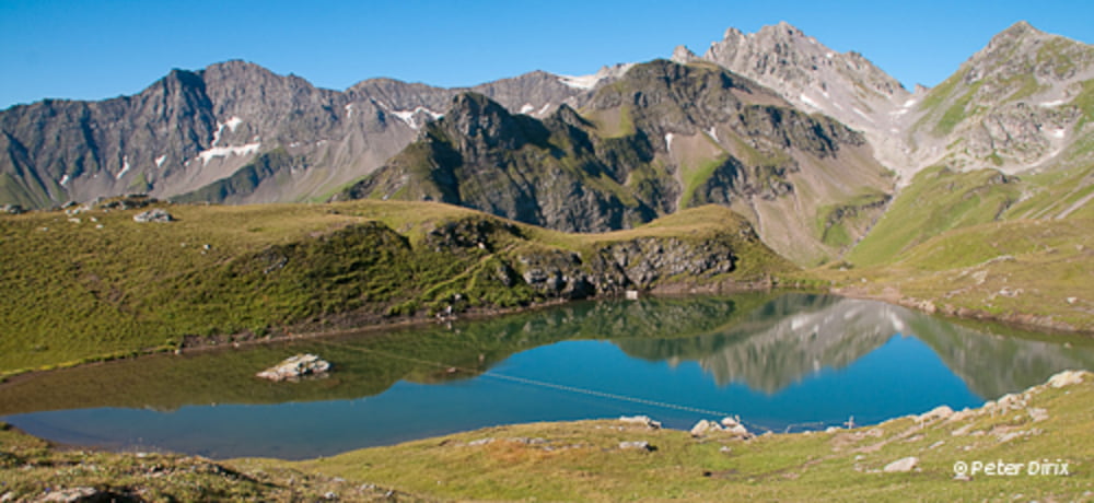
Eén van de mooiste wandelingen in Zwitserland: afwisselend en ruw terrein en 5 bijzonder mooie bergmeren.
De tocht begint bij de gondelbaan vanuit Wangs tot Furt. Van daaruit gaat het verder met de stoeltjeslift tot Gaffia en nog verder met de stoeltjeslift van Gaffia tot de Pizolhütte.
Dat is de start van de tocht. Als je alle 5 meren wil zien, moet je eerst een stukje (ong. 1km) naar links tot aan de WangserSee om daarna terug te keren naar de Pizolhütte. Indien je dat niet wil, kan je naar rechts vertrekken. Na een steile klim bereik je, de naar mijn mening mooiste See, de Wildsee. Van daar uit is het terug een stukje afdalen naar de Schottensee waarna er opnieuw een forse klim wacht naar het hoogste punt van de tocht (2505m). Het zwaarste stuk van de wandeling is nu achter de rug en van hieruit is het vooral nog afdalen naar Gaffia. Onderweg passeer je nog de 2 laatste meren, de Schwarzsee en de Baschalvasee. In Gaffia kan je dan terug naar beneden met de stoeltjeslift en de gondelbaan.
Als alternatief kan je ook vertrekken vanuit Bad Ragaz. Je neemt dan de gondelbaan Bad Ragaz-Pardiel en daarna de stoeltjeslift Pardiel-Laufböden. Zo vertrek je vóór de Wangser See. Als je de tocht via deze weg begint is er wel één belangrijk punt: de stoeltjeslift van Gaffia naar de Pizolhütte loopt maar tot 16:00u, dus je moet zien dat je ten laatste dan in Gaffia bent, anders kan je de klim te voet doen en dat is toch een heel eindje! Wij hebben deze optie moeten nemen omdat de banen vanuit Wangs in onderhoud waren.
The tour begins with the cable car from Wangs to Furt. From there it continues with the chairlift to Gaffia and on with the chairlift to the Pizolhütte.
This is the start of the tour. If you want to see all the 5 lakes, you have to go left for about 1km to the Wangsersee and then return to the Pizolhütte. If you don't want to do that, you can go right. After a steep climb you reach, the in my opinion most beautiful lake, the Wildsee. From there on, it's a bit back down to the Schottensee and then on to a new climb to the highest point of the tour (2505m). The hardest part of the tour is now behind us. On the way to Gaffia, you pass the last two lakes, Schwarzsee and Baschalvasee. In Gaffia, you take the lifts back down.
Alternatively, you can also start from Bad Ragaz. You then take the cable car Bad Ragaz-Pardiel and then the chairlift Pardiel-Laufböden. One issue though: the last run of the chairlift Gaffia-Pizolhütte is at 16:00h. We had to take this option, because the cable car from Wangs was in maintenance.
(English is not my native language, so please forgive me for any mistakes)
Más información en
http://www.pizol.com/sommer/planen-und-buchen2/wandern/5-seen-und-mehr.htmlGalería de rutas
Mapa de la ruta y perfil de altitud
Comentarios

Tracks GPS
Puntos del track-
GPX / Garmin Map Source (gpx) download
-
TCX / Garmin Training Center® (tcx) download
-
CRS / Garmin Training Center® (crs) download
-
Google Earth (kml) download
-
G7ToWin (g7t) download
-
TTQV (trk) download
-
Overlay (ovl) download
-
Fugawi (txt) download
-
Kompass (DAV) Track (tk) download
-
Hoja de ruta (pdf) download
-
Original file of the author (gpx) download


