Login

¿Ha olvidado su contraseña?

Las cookies tienen que estar habilitadas!
Las cookies no están habilitadas en tu navegador. Por favor, modifica la configuración antes de continuar.

Not a member yet?

Register now
Login

Available for registred users only

Log in to use this feature.

¿Ha olvidado su contraseña?

Las cookies tienen que estar habilitadas!
Las cookies no están habilitadas en tu navegador. Por favor, modifica la configuración antes de continuar.

Not a member yet?

Register now
Filtro
Categorías
Filtros avanzados
  • Distancia (km)
  • Altitud en metros
Guardar filtro Restablecer filtro

TrackRank

QRCode

Technical data

Distancia83,6 km Altitud en metros378 m Descenso406 m Duración06:00 h:m Fecha01.08.2010
Valoraciones Autor Paisaje Diversión Condición Técnica

Estadística

387 Visitas Valoraciones 17 Descargas Promedio
Rate
  • Hoja de ruta
  • Punto de partida
  • Descargas

Von Litomerice in Tchechien aus sind wir an der Elbe entlang flussabwärts bis Schilka gefahren. Die Strecke führt über Usti nad Labem und Decin durch die böhmische und sächsische Schweiz. Bis auf wenige kurze steile Anstiege verläuft die Strecke flach über fast immer asphaltierte Straßen.

In Decin ist ein Abstecher zum Schloß hoch über der Elbe mit der Zufahrt über den sog. langen Ritt lohnenswert. Da wir auf das Übersetzen per Fähre in Schilka verzichtet haben, ist ein kleiner Umweg über Bad Schandau hinzugekommen.

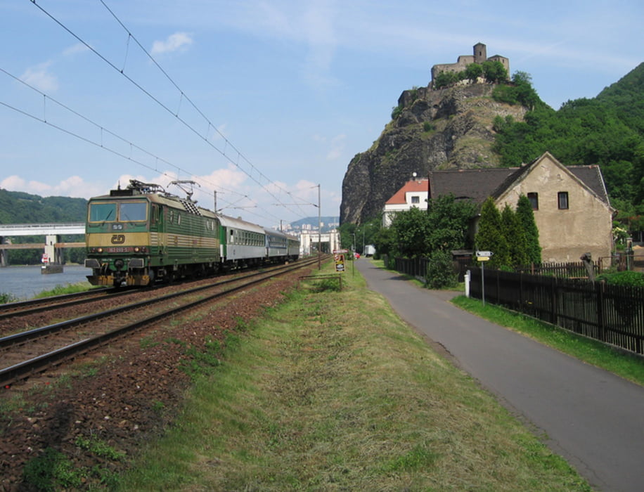
Ein Teil der Strecke führt an der Bahnlinie entlang, auf der z.T. recht skurile Fahrzeuge unterwegs sind.

Más información en

http://www.elberadweg.cz/7strecke.htm

Galería de rutas

Mapa de la ruta y perfil de altitud

  • Open Street Map
  • Google
Minimum height 109 m Maximum height 168 m Vista detallada

More about the tour author

dirkbadt
Miembro desde 2008

Enviar mensaje privado

Comentarios

Die Anfahrt erfolgt mit Hilfe einer Regionalbahn, die am Wochenende samstags und sonntags einmal täglich von Dresden Hbf durchgehend bis Litomerice fährt.

Von Schmilka oder Bad Schandau ist die Rückfahrt nach Dresden per S-Bahn kein Problem.

Tracks GPS

Puntos del track
  • GPX / Garmin Map Source (gpx) download
  • TCX / Garmin Training Center® (tcx) download
  • CRS / Garmin Training Center® (crs) download
  • Google Earth (kml) download
  • G7ToWin (g7t) download
  • TTQV (trk) download
  • Overlay (ovl) download
  • Fugawi (txt) download
  • Kompass (DAV) Track (tk) download
  • Hoja de ruta (pdf) download
  • Original file of the author (gpx) download

More about the tour author

dirkbadt
Miembro desde 2008

Enviar mensaje privado
Share track
Añadir a mis favoritos
Eliminar de mis favoritos
Edit tags
Mi valoración
Rate
Ruta: an der Elbe von Litomerice(CZ) nach Schmilka
Tipo: Bicicleta de trekking
Distancia: 83,6 km
valorizado al:
Duración:
Day(s)
Hour(s)
Minute(s)
Valoración: Paisaje Diversión Condición Técnica