


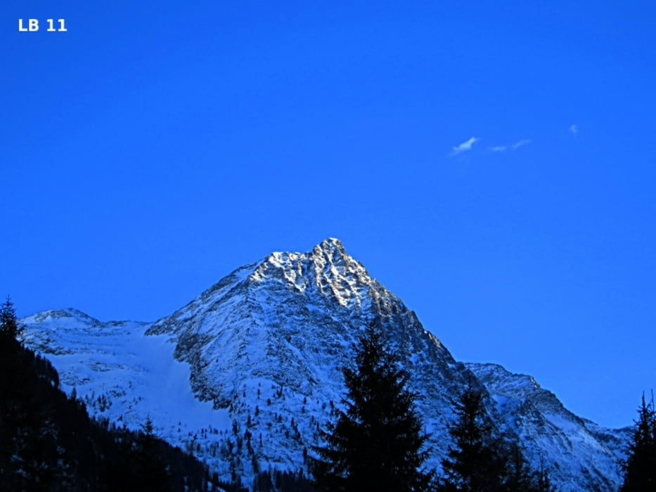
The Winter hiking trail in Rohrmoos-Untertal has a length of 12.2 km and 143 altimeters. Immediately after the start by the bridge - Hinkerbrücke you’ll walk a few meters on the road with little traffic to the inn - Tetter. Here are on 800m about 50 altimeters to overcome. Just after the inn was prepared for hikers along the road has its own way prepared. Just after the inn Tetter you have a beautiful view over the Tettermoor and the very beautiful mountains at the end of Untertal. After 3 km you reach the second Refreshment at the inn - Waldhäuslalm. Who wants to shorten the hike by car can also drive up to the Waldhäuslalm because winter driving ban only begins there. More infos, photos and video you'll see on biketours4you.at
Der Winterwanderweg in Rohrmoos-Untertal hat eine Länge von 12,2 km und insgesamt 143 Höhenmeter. Gleich nach dem Start bei der Hinkerbrücke geht es noch auf der Straße hinauf zum Gasthof Tetter. Dabei sind auf 800m ca. 50 Höhenmeter zu überwinden. Gleich nach dem Gasthof Tetter wurde für die Winter - Wanderer neben der Straße ein eigener Weg präpariert. Gleich nach dem Gasthof Tetter hat man eine wunderbare Aussicht über das Tettermoor und die Berge am Ende des Untertals. Weitere Infos und Fotos findest du auf biketours4you.at
Galería de rutas
Mapa de la ruta y perfil de altitud
Minimum height 987 m
Maximum height 1075 m
More about the tour author
|
|
Trek1400d |
Comentarios

Tracks GPS
Puntos del track-
GPX / Garmin Map Source (gpx) download
-
TCX / Garmin Training Center® (tcx) download
-
CRS / Garmin Training Center® (crs) download
-
Google Earth (kml) download
-
G7ToWin (g7t) download
-
TTQV (trk) download
-
Overlay (ovl) download
-
Fugawi (txt) download
-
Kompass (DAV) Track (tk) download
-
Hoja de ruta (pdf) download
-
Original file of the author (gpx) download
More about the tour author
|
|
Trek1400d |
Añadir a mis favoritos
Eliminar de mis favoritos
Edit tags
Open track
Mi valoración
Rate