


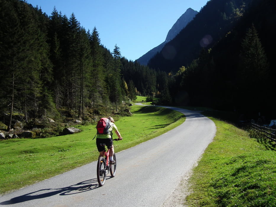
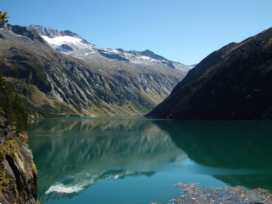
Von Mayrhofen/Schwendau durch den Ort und auf der alten Strasse zunächst steil hinauf in den Zillergrund. Weiter in angenehmer Steigung über Häusling, Au zum Gasthof Bärenbad, alles auf Teer. Durch die Schranke nun steiler hinauf, durch ein erstes beleuchtetes Tunnel zum Fuß der 186M hohen Staumauer, weiter an einem Steinbockgehege vorbei zum zweiten beleuchteten Tunnel, der endet direkt an der Staumauer Zillergründl. Oberhalb des Tunnels Gasthof Adlerblick. Dann weiter durch das dritte Tunnel auf Schotterweg am See entlang auf und ab bis zur Hohenaualm (Klein-Tibet). Rückweg auf gleichem Weg. Am See schöner Ausblick auf die Berge um die Plauener Hütte (Reichenspitzgruppe). Lohnende Trainingstour auf guten Strassen, bis zum Whs Bärenbad mit (wenig) PKW-Verkehr.
Galería de rutas


Mapa de la ruta y perfil de altitud
Minimum height 608 m
Maximum height 1915 m
More about the tour author
|
|
woke1957 |
Comentarios

Anfahrt über Inntal- Zillertal- Hippach- Schwendau. Hier kostenloser Parkplatz am Klettergarten. Die Parkplätze in Mayrhofen sind durchwegs gebührenpflichtig !
Tracks GPS
Puntos del track-
GPX / Garmin Map Source (gpx) download
-
TCX / Garmin Training Center® (tcx) download
-
CRS / Garmin Training Center® (crs) download
-
Google Earth (kml) download
-
G7ToWin (g7t) download
-
TTQV (trk) download
-
Overlay (ovl) download
-
Fugawi (txt) download
-
Kompass (DAV) Track (tk) download
-
Hoja de ruta (pdf) download
-
Original file of the author (gpx) download
More about the tour author
|
|
woke1957 |
Añadir a mis favoritos
Eliminar de mis favoritos
Edit tags
Open track
Mi valoración
Rate