

The Stevens Trail is now listed on the National Register of Historic Places.
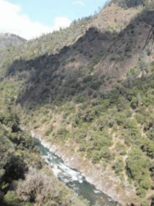
The Stevens Trail is a popular year-round hiking trail in the lower elevations of the Sierra Nevada mountain range. Historically, the trail connected the town of Iowa Hill with the city of Colfax, both in Placer County, California. The current trail extends 4.5 miles along the northwestern slope of the North Fork of the American River Canyon. It begins at the trailhead in Colfax and ends at the confluence of Secret Ravine and the North Fork of the American River.
The trail provides a gentle slope that is suitable for even the most novice hikers. From the present parking area at the headwaters of Slaughter Ravine near Colfax, the trail heads north and gradually down slopes in elevation. From there, it turns east beneath the renowned Central Pacific Railroad, Cape Horn, crossing Robbers Ravine, and finally ends at Secret Ravine.
During your journey you will enjoy a series of spectacular views of the famous Gold Rush era river, pass the infamous China Wall built by Chinese laborers, several mine shafts, and other early signs of mining. Please stay out of mines as they are unstable and extremely dangerous.
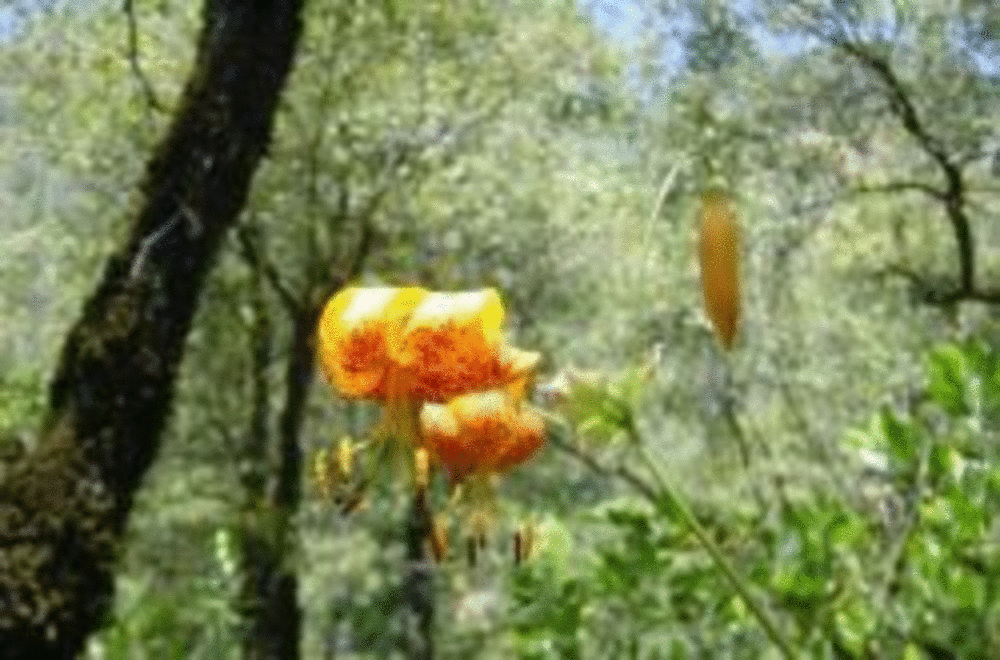
During the months of April and May, you will be treated to a beautiful wildflower display. Dogwoods and redbud represent the larger flowering plants, while baby blue eyes, shooting stars, monkey flowers, lupines and tiger lilly brighten the lower plant canopies.
Trail History: The story of the Stevens Trail begins with the establishment of the Gold Rush mining communities of Illinoistown and Iowa Hill, separated by the steep North Fork American River canyon. The Stevens Trail was originally surveyed under the ownership and direction of John Rutherford, an Iowa Hill miner and tanner. Rutherford soon brought in a partner, Truman A. Stevens, also a miner. Stevens was responsible for the completion and actual use of the trail during its main years of historic use, 1870-1895.
The trail was originally used as a toll path from Colfax down to Secret Ravine along the American River and then traveled up the other side to Iowa Hill which was a major metropolis during the Gold Rush period. Eventually, the use of the trail died down as did gold fever and it was all but forgotten until 1969 when a Sacramento area Boy Scout was credited with rediscovering the trail. Although the bridge connecting the two sides of the river no longer stands, the trail still provides a beautiful hike through an area that was once bustling with miners...all in search of gold!
Galería de rutas
Mapa de la ruta y perfil de altitud
Minimum height 381 m
Maximum height 745 m
More about the tour author

|
happyfloh |
Comentarios

Getting there: Follow I-80 East towards the town of Colfax and exit at North Canyon Way. Travel along North Canyon Way past the Colfax cemetery to the Stevens trailhead.
Trailhead Parking: Due to increased use of the Stevens Trail, on weekends and in the high use season, parking can be a problem. When parking along North Canon Way, be sure to legally park alongside the road safely out of the traffic.
Do not block driveways and please respect private property rights. Vehicles parked illegally on private property or blocking any driveway will be towed at the owners expense.
When to go: Year-round
Tracks GPS
Puntos del track-
GPX / Garmin Map Source (gpx) download
-
TCX / Garmin Training Center® (tcx) download
-
CRS / Garmin Training Center® (crs) download
-
Google Earth (kml) download
-
G7ToWin (g7t) download
-
TTQV (trk) download
-
Overlay (ovl) download
-
Fugawi (txt) download
-
Kompass (DAV) Track (tk) download
-
Hoja de ruta (pdf) download
-
Original file of the author (gpx) download
More about the tour author
|
|
happyfloh |
Añadir a mis favoritos
Eliminar de mis favoritos
Edit tags
Open track
Mi valoración
Rate